The Grade Timber Methodology: Advanced Aerial Surveillance
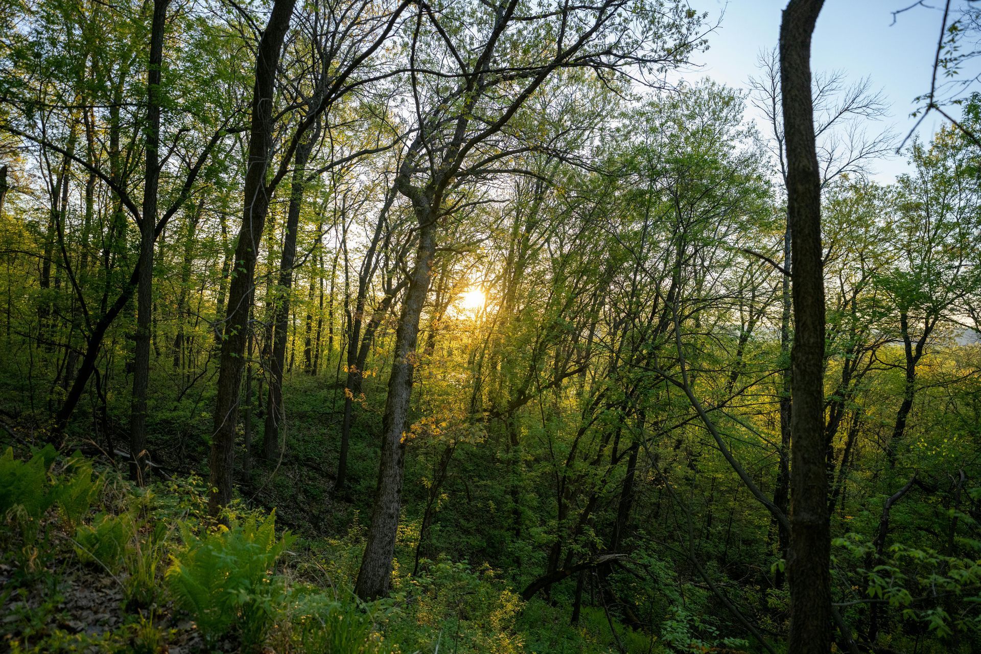
At Grade Timber, our drone services for forest health monitoring utilize unmanned aerial vehicles (UAVs) equipped with multispectral and thermal sensors to conduct comprehensive scans. These drones capture data across multiple spectral bands, including visible light, near-infrared (NIR), and thermal wavelengths, generating detailed maps of vegetation health.mdpi.com A key metric we employ is the Normalized Difference Vegetation Index (NDVI), which measures plant vigor by analyzing how vegetation reflects light—healthy plants absorb visible light for photosynthesis while reflecting NIR, whereas stressed ones show altered patterns.
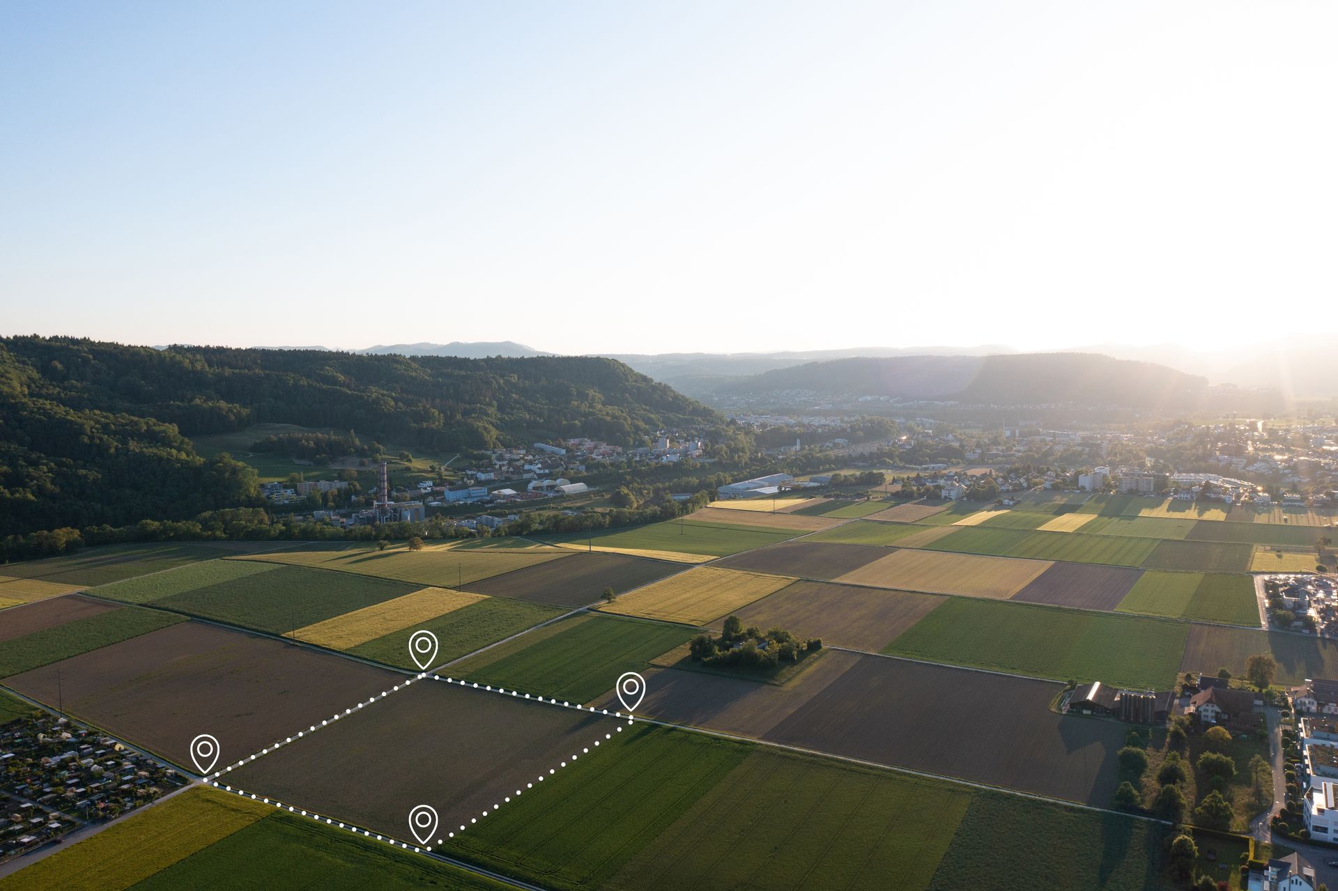
Our process begins with customized flight planning: Drones are programmed to fly at optimal altitudes (typically 100-150 meters) with overlapping coverage to ensure complete data capture. Flights can be scheduled regularly, such as bi-monthly during peak growing seasons, to track canopy changes over ime.sciencedirect.com Raw data is processed using specialized software to create orthomosaics and 3D models, where AI algorithms automate anomaly detection. For instance, machine learning models like convolutional neural networks (CNNs) classify stress levels with accuracies reaching 90-97%, identifying issues like chlorophyll loss or water stress before symptoms manifest.pmc.ncbi.nlm.nih.gov Systematic reviews confirm that UAVs fill critical gaps in forest health monitoring (FHM), providing high-resolution data for both biotic (e.g., pests) and abiotic (e.g., drought) threats.researchgate.net
Integration of AI enhances precision; for example, random forest classifiers and deep learning models analyze multispectral imagery to pinpoint diseased trees with kappa coefficients up to 0.91.tandfonline.com LiDAR sensors complement this by mapping canopy structure, revealing defoliation or gaps indicative of decline.mdpi.com This non-invasive approach minimizes disturbance while delivering actionable insights, such as heat maps highlighting hotspots for targeted interventions.
Real-World Applications: Case Studies in Action
The efficacy of drone-based monitoring is evident in diverse applications. In pine wilt disease (PWD) detection—a major threat caused by nematodes—UAVs have proven transformative. A study in Weihai, China, used high-resolution drone imagery (3.977 cm/pixel) processed with an enhanced YOLOv8 algorithm, achieving a mean average precision (mAP) of 81% for identifying diseased pines.mdpi.com The model incorporated attention mechanisms to focus on small targets, reducing false negatives in dense forests. This timely detection allows for selective removal of infected trees, curbing spread and preserving healthy stands.mdpi.com Similarly, in North China, hyperspectral UAV data combined with support vector machines enabled early PWD detection in Pinus tabuliformis, with implications for large-scale forest protection.pmc.ncbi.nlm.nih.gov
Another compelling example comes from West Virginia and Pennsylvania, where drones assessed ash decline due to the emerald ash borer. Researchers captured 6174 aerial images across deciduous forests, using deep learning models like Mask2former to segment declining trees.researchgate.net The model achieved AP50 of 0.789 and mAP of 0.542, enabling precise mapping of affected areas.pubmed.ncbi.nlm.nih.gov Field validations confirmed its utility for hard-to-access sites, supporting interventions that saved significant timber value.researchgate.net At Grade Timber, we apply similar techniques to monitor species like Pinus radiata or oaks, detecting bark beetle infestations with multispectral time series, achieving accuracies of 78-96%.mdpi.com
These case studies underscore drones' role in outperforming ground methods, especially in rugged terrains where traditional surveys risk safety and miss subtle changes.
Compelling Benefits for Landowners
Adopting drone monitoring at Grade Timber yields multifaceted benefits. Early intervention can reduce losses by up to 50%, as proactive treatments like insecticide applications or tree removal prevent escalation.prism.sustainability-directory.com Cost savings are substantial: UAV surveys are 50-80% cheaper than manual assessments, with reduced labor and faster turnaround—days versus weeks.mdpi.com Enhanced safety is another boon, eliminating the need for crews in hazardous areas.rvslandsurveyors.com Beyond economics, this supports sustainability: Healthy forests bolster carbon sequestration, qualifying landowners for incentives like carbon credits or conservation grants.sciencedirect.com Biodiversity thrives with minimized disturbances, and data-driven decisions optimize yields for long-term productivity. Studies show productivity gains of up to 300% in monitoring efficiency, translating to better financial outcomes.dronemajor.net
Looking Ahead: AI and Predictive Integrations
The future of forest monitoring lies in deeper AI integrations. Predictive analytics, powered by machine learning, will forecast outbreaks by analyzing trends in NDVI data and environmental variables.sciencedirect.com Explainable AI (XAI) will build trust by clarifying model decisions, aiding in wildfire detection via thermal drones or pest forecasting.sciencedirect.com At Grade Timber, we're exploring these advancements, including hybrid UAVs for larger coverage and real-time data streaming for immediate alerts.land.unece.org This evolution toward precision forestry promises even greater resilience against climate threats.
Protect Your Forest's Future with Grade Timber
In conclusion, drone-based forest health monitoring is a game-changer, turning potential crises into manageable challenges. By detecting diseases early and providing data-driven strategies, Grade Timber helps landowners safeguard their assets, enhance sustainability, and maximize returns. Don't wait for visible decline—schedule a consultation today to implement robust protection for your timberlands.
Thought for 28s
Streamlining Reforestation Planning
In the face of escalating deforestation, climate change, and biodiversity loss, reforestation has emerged as a critical pillar of global sustainability efforts. Restoring degraded lands not only sequesters carbon and combats erosion but also revitalizes ecosystems, supports wildlife habitats, and bolsters local economies through timber production and ecotourism. However, effective reforestation planning demands intricate site-specific insights—understanding topography, soil quality, existing vegetation, and microclimates to ensure optimal species selection and planting strategies. Traditional methods, reliant on manual surveys and ground-based mapping, are often slow, costly, and limited in scope, particularly in remote or rugged terrains. At Grade Timber, we revolutionize this process with drone services that provide high-resolution visual assessments, enabling precise, data-driven planning for successful reforestation outcomes.
The challenges of conventional reforestation planning are multifaceted. Ground teams may take weeks to traverse large areas, facing hazards like steep slopes or wildlife, while satellite imagery lacks the granularity needed for detailed analysis. Drones address these gaps by offering agile, non-invasive aerial perspectives that capture vast landscapes in hours. By integrating unmanned aerial vehicles (UAVs) with advanced sensors, Grade Timber delivers comprehensive site evaluations that inform every stage of reforestation—from initial assessment
to post-planting monitoring.
The Grade Timber Methodology: Precision Mapping for Optimal Planting
Our drone services begin with thorough site reconnaissance using UAVs equipped with LiDAR (Light Detection and Ranging), multispectral cameras, and high-resolution RGB sensors. These tools map topography with centimeter-level accuracy, generating digital elevation models (DEMs) that reveal slopes, drainage patterns, and potential erosion risks—essential for determining planting zones.weforum.org Multispectral imaging analyzes soil composition by detecting variations in moisture, nutrient levels, and organic matter through spectral reflectance, helping identify fertile patches versus degraded ones.news.mongabay.com AI algorithms process this data to predict tree survival rates, factoring in variables like sunlight exposure, wind patterns, and species suitability, with models achieving up to 90% accuracy in forecasting outcomes.tandfonline.com
A standout innovation in our arsenal is drone-based seed bombing, where UAVs disperse specially designed seed pods at high speeds. Companies like AirSeed Technologies, which we draw inspiration from, have demonstrated the ability to deploy up to 40,000 pods per day, each containing native seeds coated in protective nutrients and bio-materials to enhance germination.advexure.com The process starts with pre-flight planning: Drones scan the site to create a 3D map, then algorithms calculate efficient flight paths for uniform distribution, avoiding overlaps and targeting inaccessible areas.news.mongabay.com Pods burst on impact, embedding seeds into the soil, which is particularly effective in post-fire or mined landscapes where human access is risky.
This methodology not only accelerates planning but also integrates with GIS platforms for layered analysis, combining drone data with climate projections to select resilient species. For instance, in variable terrains, LiDAR helps delineate micro-sites for diverse planting, promoting polycultures that mimic natural forests for greater ecological stability.nationalforests.org