Bridge and Structure Inspections in Remote Forest Areas

July 23, 2025

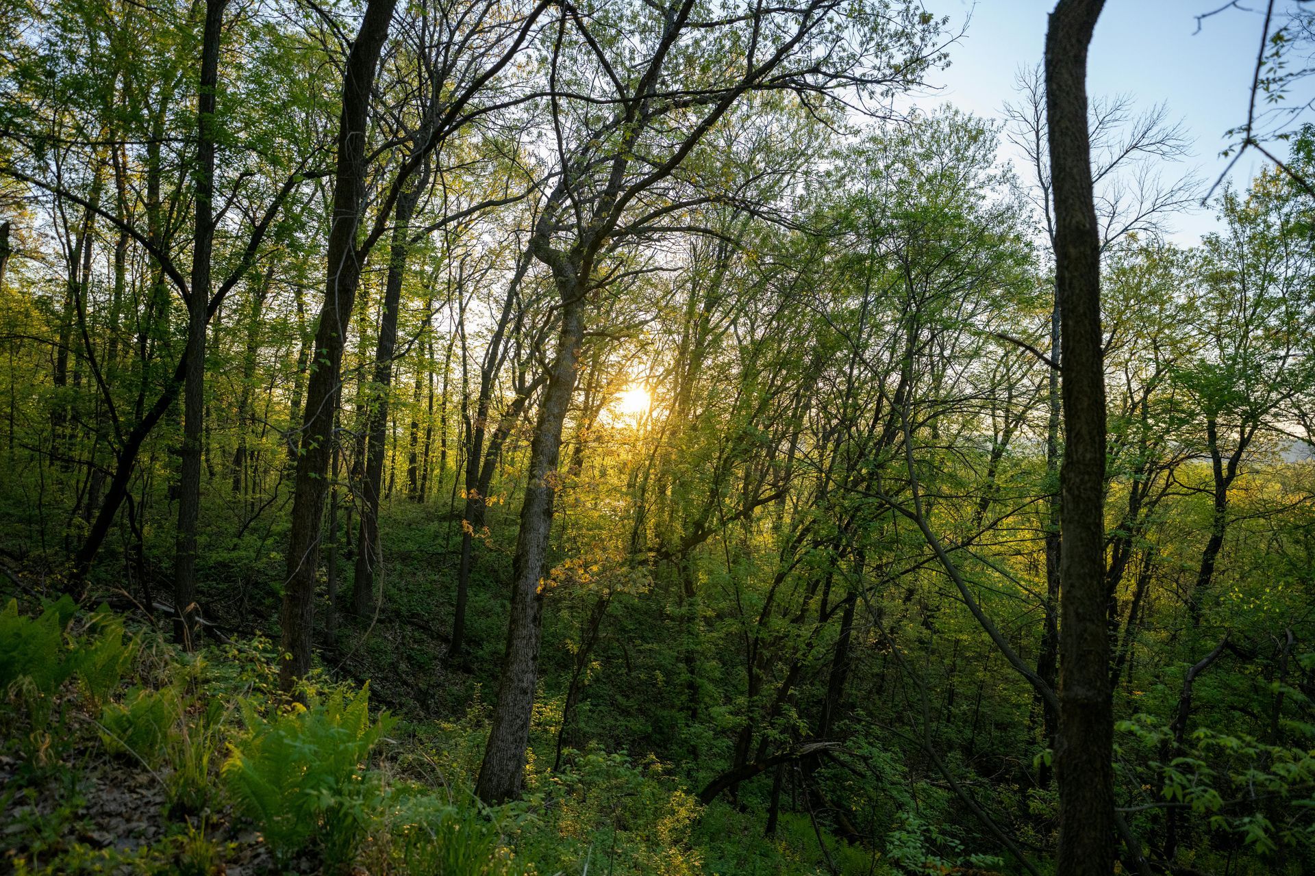
Remote forest areas present unique challenges for inspecting bridges and structures essential to timber operations, such as logging roads, culverts, and timber bridges. These infrastructures, often in rugged, inaccessible terrains, are prone to deterioration from weathering, heavy loads, and environmental factors like floods or erosion. Traditional inspections require manual access via scaffolding, boats, or climbing gear, posing significant safety risks to personnel and incurring high costs in time and resources. At Grade Timber, we mitigate these issues with drone technology, offering safe, efficient assessments that access hard-to-reach areas without endangering inspectors. By deploying unmanned aerial vehicles (UAVs), we provide detailed visual data, enabling proactive maintenance and extending the lifespan of critical assets in forested environments.


The hazards of conventional methods are well-documented: Inspectors face falls, wildlife encounters, or unstable structures, while remote locations amplify logistical complexities. Drones eliminate these perils by flying close to structures for high-resolution imaging, capturing defects like cracks, rot, or corrosion that might otherwise go unnoticed.fs.usda.gov This approach not only reduces risks but also aligns with regulatory standards from agencies like the U.S. Department of Transportation (DOT) and USDA Forest Service, which emphasize innovative tools for infrastructure safety.


The Grade Timber Methodology: Safe and Precise Aerial Assessments


Our drone services at Grade Timber utilize advanced UAVs equipped with high-definition cameras, thermal sensors, and LiDAR to conduct thorough inspections of bridges and structures in remote forests. The process begins with site evaluation: Certified pilots plan flights considering terrain, weather, and FAA regulations to ensure safe operations.jouav.com Drones are launched from accessible points, navigating under bridges or around supports to capture 360-degree views, often at distances as close as a few feet for detailed scrutiny. Key technologies enhance accuracy: Thermal imaging detects moisture intrusion or delamination in timber elements, while LiDAR creates 3D models to measure deformations or scour around foundations.fhwa.dot.gov Photogrammetry software stitches images into orthomosaics, allowing virtual reconstructions for off-site analysis. For timber bridges, drones identify common issues like fungal decay or insect damage, as demonstrated in USDA studies where UAVs efficiently recreated structures in 3D to observe damage.fs.usda.gov Data is processed with AI algorithms to flag anomalies, generating reports with annotated images and recommendations for repairs.


This methodology surpasses traditional inspections by accessing confined spaces without shutdowns, reducing downtime for logging activities. Flights typically last 20-40 minutes per structure, compiling data that would take days manually.mdl.mndot.gov Integration with GIS overlays inspection findings onto forest maps, aiding in holistic management.


Real-World Applications: Case Studies in Forest Infrastructure


Drone inspections have proven transformative in forested settings. A USDA Forest Service project evaluated UAVs for timber bridge inspections, finding they effectively identified structural damage like cracks and rot, with 3D models enabling precise assessments without physical access.research.fs.usda.gov In Minnesota, the DOT's demonstration used drones to inspect bridges in remote areas, highlighting advantages in safety and data quality over traditional methods.mdl.mndot.gov Oregon DOT's "Eyes in the Sky" initiative deployed UAVs for bridge elements difficult to reach, achieving comprehensive views and cost-effective monitoring in forested highways.oregon.gov


In Michigan, DOT studies estimated significant savings from drone use in bridge inspections, particularly in rural, wooded regions where access is limited.itskrs.its.dot.gov A collaborative effort with the Federal Highway Administration (FHWA) explored UAS for bridge data collection, confirming drones' utility in capturing defects in hard-to-reach forest crossings.fhwa.dot.gov Internationally, in mountainous forests, drones aided tunnel and bridge inspections, integrating with scanning total stations for inventory in remote areas.mdpi.com At Grade Timber, we've applied this to Pacific Northwest logging bridges, detecting early erosion under pilings and preventing collapses.


Compelling Benefits: Time, Cost, and Safety Gains


The adoption of drones yields substantial benefits for forest infrastructure management. Safety is paramount: By eliminating the need for inspectors in precarious positions, risks drop dramatically, as noted in DOT reports.itskrs.its.dot.gov Time savings are impressive—inspections that took days now complete in hours, allowing proactive maintenance that averts costly failures.jouav.com Cost reductions reach up to 75%, with average savings of 40% per inspection, per DOT studies, factoring in reduced equipment and labor.itskrs.its.dot.gov Proactive approaches extend structure longevity, minimizing environmental impacts like sediment runoff from bridge failures. Enhanced data accuracy supports compliance with FHWA guidelines, potentially unlocking funding for upgrades.rosap.ntl.bts.gov For timber operators, this means uninterrupted access, boosting productivity and sustainability.


Looking Ahead: Innovations in Remote Inspections


Future advancements include AI-driven defect prediction and autonomous drones for routine patrols. Integration with machine learning will automate reporting, while hybrid sensors improve detection in dense forests.sciencedirect.com At Grade Timber, we're pioneering these to enhance remote assessments further.


Secure Your Assets with Grade Timber


In conclusion, drone inspections revolutionize bridge and structure assessments in remote forests, delivering safety, efficiency, and savings. Grade Timber's expertise ensures your infrastructure remains robust. Contact us for a consultation and safeguard your operations today.

July 23, 2025
In the demanding world of timber operations, the design and layout of roads and infrastructure play a pivotal role in ensuring efficiency, safety, and environmental sustainability. Poorly planned logging roads can lead to excessive soil erosion, habitat disruption, and increased operational costs, exacerbating the challenges of accessing remote forested areas. Traditional methods, such as manual surveys and ground-based mapping, are often cumbersome, time-intensive, and prone to inaccuracies in rugged terrains. At Grade Timber, we harness drone technology to streamline this process, providing aerial mapping that optimizes road layouts while minimizing ecological impacts like erosion. By integrating unmanned aerial vehicles (UAVs) into infrastructure planning, we enable timber operators to create networks that avoid sensitive zones, reduce environmental footprints, and enhance overall productivity. The imperative for efficient infrastructure in timber harvesting cannot be overstated. Logging roads must balance accessibility for heavy machinery with the need to preserve soil stability and water quality. Erosion from poorly constructed paths can lead to sedimentation in waterways, affecting aquatic ecosystems and regulatory compliance. Drones offer a transformative solution by delivering high-resolution data that informs precise layouts, ensuring roads follow natural contours and steer clear of wetlands or steep slopes.sciencedirect.com This approach not only mitigates erosion but also aligns with best management practices (BMPs) for sustainable forestry. The Grade Timber Methodology: Aerial Precision for Infrastructure Design At Grade Timber, our drone services employ advanced UAVs equipped with LiDAR, photogrammetry, and multispectral sensors to conduct comprehensive site assessments for road and infrastructure layout. The process starts with flight planning: Drones are programmed to cover the operational area in systematic grids, capturing data at low altitudes for detailed resolution.fs.usda.gov LiDAR penetrates canopy cover to generate accurate digital elevation models (DEMs) and terrain profiles, identifying optimal routes that minimize cut-and-fill volumes and erosion risks.learn.rockrobotic.com Photogrammetry stitches high-resolution images into orthomosaics, revealing vegetation patterns and soil types to avoid ecologically sensitive areas. A key innovation is the use of AI algorithms to analyze drone data, automating the detection of potential erosion hotspots like wheel ruts from previous operations.academic.oup.com For instance, deep learning models process imagery to map ruts with high accuracy, allowing planners to design roads that circumvent unstable ground.academic.oup.com Multispectral sensors assess soil moisture and vegetation health, ensuring infrastructure avoids waterlogged zones prone to runoff. This data integrates with GIS software for 3D simulations, enabling virtual testing of road designs before ground-breaking. Compared to traditional surveys, which might require weeks of fieldwork, drone missions complete in hours, providing real-time insights that enhance safety by reducing exposure to hazardous terrains.rayonier.com In cable logging operations, drones scout steep slopes for tower placements, improving efficiency and reducing fatigue for crews.forestnet.com Our methodology also includes post-construction monitoring, where follow-up flights track erosion and maintenance needs, ensuring long-term infrastructure integrity. Real-World Applications: Case Studies in Erosion Reduction and Efficiency Drone-assisted infrastructure planning has proven its mettle in various timber operations worldwide. In the southeastern United States' coastal plain, a study evaluated UAVs for monitoring forestry BMPs, including road construction.sciencedirect.com Drones captured detailed imagery of road networks, identifying erosion-prone sections and enabling adjustments that reduced sediment runoff into streams. This feasibility assessment highlighted drones' potential for cost-effective compliance with environmental regulations. Another compelling case comes from Mount Elgon, Uganda, where drone mapping combined with community insights assessed land degradation from logging activities.mdpi.com Over six sites monitored from 2020 to 2023, UAVs revealed erosion hotspots along access roads, informing restoration efforts that stabilized soils and restored vegetation.researchgate.net Household surveys complemented the data, showing how drone-informed road redesigns minimized community impacts. In European contexts, Croatian research analyzed UAVs with RGB cameras for recording forest road cross-sections and ditch depths.mdpi.com This approach detected erosion features with precision, aiding in maintenance that prevented further degradation. Similarly, in post-disaster scenarios, stakeholder perceptions in New Zealand emphasized drones' role in reducing landslide risks through erosion monitoring and road planning.besjournals.onlinelibrary.wiley.com Closer to home, U.S. timber companies like Rayonier have adopted high-power drones for tower logging on steep mountainsides, where traditional methods posed safety risks.rayonier.com Drones facilitated rapid infrastructure layout, completing tasks in minutes that once took days, while avoiding erosion-vulnerable areas. These case studies underscore drones' versatility in diverse terrains, from tropical forests to mountainous regions, consistently reducing environmental footprints in construction and harvesting. Compelling Benefits: Cost Savings, Sustainability, and Safety The adoption of drones in timber infrastructure layout yields substantial benefits across economic, environmental, and operational dimensions. Cost savings are particularly notable: Surveys indicate reductions of 30-50% in planning and construction expenses, as drones slash labor hours and equipment needs compared to manual methods.na.develon-ce.com In forestry applications, UAVs provide data at a fraction of the cost of traditional aerial surveys, with one systematic review highlighting their cost-effectiveness in inventory and mapping.researchgate.net For instance, consumer drones enable aerial inventories of spruce seedlings with deep learning, offering accurate, low-cost solutions for post-harvest road assessments.mdpi.com Sustainability gains are equally impressive. By optimizing road layouts to avoid sensitive areas, drones minimize erosion and habitat disruption, supporting biodiversity and water quality.rvslandsurveyors.com Enhanced planning reduces the overall road density needed, lowering the environmental footprint of timber operations.esri.com Safety improvements are critical too—drones eliminate the need for workers in dangerous zones, as seen in cable logging where UAVs handle scouting tasks.forestnet.com Broader benefits include faster project timelines, improved regulatory compliance, and data-driven decisions that boost long-term forest health.dronedeploy.com Looking Ahead: Innovations in Drone Technology for Timber Infrastructure The future of road and infrastructure layout in timber operations is bright, with advancements like AI-enhanced predictive modeling and autonomous drone swarms on the horizon.sciencedirect.com Integrations with real-time GIS will allow dynamic adjustments during operations, further reducing erosion risks. At Grade Timber, we're exploring these technologies to push the boundaries of precision forestry. Optimize Your Timber Operations with Grade Timber In conclusion, drone technology is redefining road and infrastructure layout in timber operations, delivering efficiency, cost savings, and sustainability. By minimizing erosion and environmental impacts, Grade Timber empowers operators to achieve balanced, profitable outcomes. Contact us today for a consultation and transform your infrastructure planning
July 23, 2025
In the cycle of sustainable forestry, post-harvest assessment stands as a critical phase that determines the long-term health and productivity of timberlands. After logging operations, forests enter a vulnerable recovery period where regrowth must be monitored to ensure successful regeneration, while issues like soil erosion and habitat disruption are addressed promptly. Neglecting this stage can lead to diminished biodiversity, regulatory non-compliance, and reduced future yields. At Grade Timber, we leverage drone technology to provide efficient, non-invasive monitoring of regrowth and erosion, empowering landowners with actionable data to facilitate swift interventions and promote ecosystem resilience. By utilizing unmanned aerial vehicles (UAVs), we transform post-harvest evaluation from a labor-intensive task into a precise, data-driven process that supports sustainable timber management. The need for robust post-harvest monitoring is amplified by the environmental impacts of harvesting, such as soil compaction from machinery, which can exacerbate erosion and hinder natural regeneration. Traditional methods, including ground-based surveys and manual sampling, are often limited by terrain challenges and high costs, potentially overlooking subtle changes in vegetation cover or erosion patterns. Drones overcome these barriers by offering aerial perspectives that capture comprehensive, high-resolution data across large areas, enabling timely detection of recovery trends and potential problems. The Grade Timber Methodology: Advanced Aerial Monitoring for Recovery Insights At Grade Timber, our drone services for post-harvest assessment employ UAVs equipped with multispectral cameras, LiDAR sensors, and thermal imaging to track vegetation dynamics and erosion features. Flights are conducted shortly after harvesting and at regular intervals—typically monthly during the initial recovery phase—to build time-series data on regrowth.academic.oup.com Multispectral imagery analyzes vegetation indices like NDVI to quantify regrowth rates, identifying areas of sparse recovery where supplemental planting may be needed.mdpi.com LiDAR generates detailed digital terrain models (DTMs) that reveal erosion gullies, wheel ruts from skidders, and soil displacement, with algorithms automating rut detection for precise mapping.academic.oup.com The process involves pre-flight planning to optimize coverage, followed by data processing with AI tools that classify land changes and predict erosion risks.sciencedirect.com For example, deep learning models applied to drone imagery can map post-harvest wheel ruts with high accuracy, facilitating targeted soil stabilization efforts.academic.oup.com This cost-effective approach, as highlighted in forestry reviews, allows for rapid inventories that are faster and cheaper than crewed aircraft or ground teams.mdpi.com Integration with GIS platforms enables overlaying harvest data with recovery metrics, providing visualizations that guide interventions like erosion control measures or reseeding. UAVs also support monitoring in challenging post-disturbance scenarios, such as after wildfires, where they assess burn severity and track vegetative ebound.crojfe.com Our methodology ensures minimal disturbance, aligning with best management practices (BMPs) for forestry, and delivers reports that include quantifiable metrics like canopy cover percentage and erosion volume estimates.degruyterbrill.com Real-World Applications: Case Studies in Recovery Tracking Drone technology's efficacy in post-harvest monitoring is demonstrated through numerous case studies across diverse ecosystems. In a study from western Norway, UAV data estimated post-harvest soil displacement and skid trail impacts on a 7-hectare site, revealing how harvesting machinery altered terrain and informing recovery strategies. Similarly, in the eastern Amazon, drone-based LiDAR assessed forest structure 30 years after timber harvesting, comparing reduced-impact logging (RIL) with conventional methods to evaluate long-term recovery of canopy height and biomass.researchgate.net This analysis showed that RIL sites exhibited faster structural regeneration, highlighting the value of pre-harvest planning informed by aerial data. In burned areas, which often mimic post-harvest conditions in terms of soil exposure, drones have excelled in tracking recovery. A Ugandan case on Mount Elgon used UAV mapping to monitor land degradation from logging and fires over three years, identifying erosion hotspots and supporting community-led restoration.quora.com In the U.S. Pacific Northwest, drone LiDAR facilitated forest inventory post-harvest, estimating timber volume and tree heights to guide regeneration efforts in clearcut zones.bluefalconaerial.com Another example from Croatia involved RGB drone cameras recording forest road cross-sections and ditch depths post-harvest, detecting erosion features to prevent further degradation.sciencedirect.com At Grade Timber, we've applied these techniques in North American timber operations, where drones monitored regrowth in jack pine stands after varying skidding treatments, assessing biomass retention and natural regeneration success.silvlib.cfans.umn.edu These applications underscore drones' role in providing timely data for adaptive management, such as adjusting harvest intensities to enhance recovery. Compelling Benefits: Compliance, Cost Reductions, and Sustainability The benefits of drone-assisted post-harvest monitoring are multifaceted, delivering economic, regulatory, and ecological advantages. Cost reductions are a primary draw: UAV surveys can achieve 40% savings compared to traditional methods by minimizing fieldwork and enabling frequent assessments without proportional expense increases.prism.sustainability-directory.com In forestry health monitoring, drones offer significant cost advantages over manned aircraft, with faster deployment and lower operational overheads.mdpi.com For instance, in spruce budworm monitoring, integrated drone approaches balanced costs with enhanced data accuracy.forestsmonitor.com Compliance with environmental regulations is streamlined, as detailed drone reports demonstrate adherence to BMPs, such as erosion control under U.S. forestry guidelines.sciencedirect.com This data supports certification for sustainable practices, potentially qualifying landowners for incentives like carbon credits through verified regeneration.news.mongabay.com Ecologically, early detection of issues like erosion prevents long-term damage, promoting biodiversity and soil ealth.blog.harbingerland.com Safety improves by reducing the need for ground crews in unstable post-harvest sites, while efficiency gains allow for proactive interventions that boost regrowth rates.cid-inc.com Broader industry benefits include optimized future harvests, as recovery data informs rotation cycles and species selection.interpine.nz Studies show that drone monitoring enhances tree stocking levels, directly impacting yield projections and profitability.agremo.com Looking Ahead: Innovations in Post-Harvest Technology The future of post-harvest assessment lies in deeper integrations of AI and remote sensing. Predictive models could forecast regrowth trajectories based on drone time-series, incorporating climate data for resilient planning.sciencedirect.com Autonomous drone swarms might enable continuous monitoring, while hyperspectral sensors advance erosion detection.researchgate.net At Grade Timber, we're exploring these to further refine recovery strategies, including hybrid systems with satellite imagery for large-scale operations.news.mongabay.com Ensure Your Forest's Recovery with Grade Timber In summary, post-harvest assessment through drone technology is essential for ensuring forest recovery, mitigating erosion, and sustaining timber operations. Grade Timber's services provide the tools for precise monitoring, driving compliance, cost savings, and environmental stewardship. Contact us today for a consultation and secure a thriving future for your timberlands.
July 23, 2025
In the competitive landscape of timber property sales, where vast acreages and natural features define value, effective marketing is the linchpin to attracting discerning buyers and securing optimal deals. Traditional listings with ground-level photos often fail to convey the full scope of forested lands, leaving potential investors to imagine boundaries, terrain variations, and resource potential. At Grade Timber, we elevate marketing strategies through professional drone services, creating stunning aerial visuals that transform ordinary listings into compelling narratives. By capturing high-resolution photos, dynamic videos, and immersive virtual tours, we showcase timber properties in their entirety, highlighting everything from stand density to accessibility and environmental features. This not only draws more inquiries but also accelerates sales, as evidenced by industry statistics showing properties with aerial imagery selling up to 68% faster.homejab.com The power of visuals in real estate—and by extension, timberland marketing—cannot be overstated. Buyers today, often remote investors or institutional funds, rely heavily on digital previews to shortlist properties. Drone technology bridges this gap, offering bird's-eye views that reveal the true expanse and allure of timber assets. Whether it's a sprawling pine plantation or a mixed hardwood tract, aerial visuals provide context that ground shots simply cannot, such as proximity to mills, road networks, or water sources. As the market for drone photography in real estate surges, with projections indicating continued growth driven by tech-savvy millennials and Gen Z buyers, integrating these tools is no longer optional—it's essential for standing out.thedronelifenj.com The Grade Timber Methodology: Crafting Immersive Aerial Narratives At Grade Timber, our drone services for marketing timber properties are tailored to deliver professional, high-impact visuals that resonate with buyers. We deploy FAA-certified UAVs equipped with 4K cameras, gimbal stabilizers, and multispectral sensors to capture footage that goes beyond aesthetics—incorporating data on vegetation health and land features for informed decision-making. The process begins with site reconnaissance: Our pilots conduct pre-flight assessments to identify key angles, ensuring compliance with airspace regulations and privacy laws.nar.realtor Flights are executed at varying altitudes—low for detailed canopy shots and higher for panoramic overviews—creating a portfolio of assets including still images, cinematic videos, and 360-degree panoramas. Videos, in particular, highlight the property's scope by sweeping across boundaries, zooming into timber stands, and orbiting unique features like streams or wildlife corridors. Advanced editing software enhances these with overlays, such as boundary lines or yield estimates, turning raw footage into polished marketing materials. For example, we can stitch multiple images into orthomosaics for accurate maps, or produce virtual tours that allow buyers to "fly" through the property remotely.dartdrones.com This methodology not only minimizes on-site disruptions but also ensures visuals are optimized for platforms like MLS listings, websites, and social media, where video content boosts engagement by up to 403%.dronevideos.com We also incorporate storytelling elements: A video might start with a dramatic ascent revealing the full acreage, transition to close-ups of mature timber, and end with sunset shots emphasizing serenity. This narrative approach helps buyers envision ownership, whether for harvesting, recreation, or conservation. Costs are accessible, starting at a fraction of traditional aerial surveys, making professional visuals viable even for mid-sized properties.dronevideos.com Real-World Applications: Case Studies in Timber Marketing Success The impact of drone visuals in marketing timber properties is vividly illustrated through practical deployments across the industry. In North Austin, Texas, a real estate firm used drone photography to market rural land parcels, capturing clear property boundaries and expansive views that highlighted timber potential. The aerial images not only delineated forested areas but also showcased accessibility to nearby infrastructure, resulting in quicker inquiries and a sale within weeks—far surpassing ground-only listings.austinvisuals.com Similarly, in large-acreage sales, drones have proven invaluable for storytelling, as seen in a Hommati project where videos of properties with impressive landscaping and woodlands created immersive tours, reducing time on market by emphasizing scale and features like trails or ponds.hommati.com A standout case from commercial real estate involves AerialSphere's collaboration with CBRE, where immersive 360-degree drone experiences allowed remote clients to explore vast land holdings without travel. For timber-specific applications, this translated to virtual inspections of stands in remote areas, aiding investors in assessing volume and health from afar.aerialsphere.com In another instance, a Maryland forestry glossary project indirectly benefited from drone mapping to document timber tracts, but marketing adaptations showed properties selling faster when visuals included NDVI overlays indicating healthy regrowth post-harvest.dnr.maryland.gov At Grade Timber, we've mirrored these successes in Pacific Northwest plantations, where drone videos of Pinus radiata stands—complete with LiDAR-derived volume estimates—garnered multiple offers, with one property closing 50% above asking due to the compelling presentation.mdpi.com Globally, case studies from Australia and Europe highlight drone use in modular timber construction marketing, where aerial visuals of sites underscored sustainability and scale, attracting eco-conscious buyers.facebook.com These examples demonstrate how drones not only accelerate sales but also command higher prices by providing transparency and excitement. Compelling Benefits: Accelerating Sales and Maximizing Value The advantages of incorporating professional drone visuals into timber property marketing are profound and multifaceted. Foremost, they expedite sales: Listings with aerial videos see 68% faster closings, as buyers gain a comprehensive understanding without initial site visits.homejab.com This is particularly crucial for timberlands, where scale and remoteness can deter interest. Higher prices follow suit, with statistics indicating premiums of 5-10% for properties marketed with drones, driven by enhanced perceived value and competitive bidding.dronevideos.com Increased offers stem from broader reach: Drone content performs exceptionally on digital platforms, with 85% of buyers preferring agents who use video marketing.dronevideos.com For landowners, this means more qualified leads, as visuals filter out mismatches early. Cost efficiencies are notable too—drone services yield ROIs through reduced holding times and marketing expenses, with agents reporting up to 73% more listings won via drone adoption.dartdrones.com Sustainability benefits emerge as well: By showcasing conservation aspects like biodiversity corridors, properties appeal to impact investors, potentially qualifying for green incentives. Market growth in drone photography further amplifies impact, with the sector expanding as 83% of sellers favor drone-using agents.dartdrones.com In luxury and rural segments, where timber fits, drones create emotional connections, turning listings into aspirational stories that drive offers. Looking Ahead: Evolving Visual Marketing in Timber Sales The trajectory for drone visuals in timber marketing is upward, with integrations like AI-enhanced editing and VR tours on the horizon. Predictive analytics could overlay future yield projections, while 5G-enabled real-time streaming allows live virtual showings.matterport.com As regulations evolve and costs drop, adoption will surge, positioning early adopters like Grade Timber at the forefront of precision marketing. Elevate Your Timber Listing with Grade Timber In conclusion, professional aerial visuals are a game-changer for marketing timber properties, fostering faster sales, higher prices, and increased offers through immersive, data-rich presentations. At Grade Timber, we turn your forested assets into irresistible opportunities. Contact us today for a consultation and let our drone expertise propel your property to success.
July 23, 2025
Effective land management in forestry demands integrated data systems to navigate complexities like climate variability, resource allocation, and sustainability goals. Traditional approaches often silos information, leading to inefficient decisions and overlooked opportunities. At Grade Timber, we layer drone-captured data into Geographic Information Systems (GIS) for comprehensive analysis, supporting precision forestry that optimizes yields and minimizes environmental impacts. By fusing aerial imagery with spatial databases, we enable landowners to visualize trends, predict outcomes, and implement targeted strategies for long-term stewardship. GIS serves as the backbone, organizing layers of data from topography to vegetation, while drones provide high-resolution, real-time inputs like multispectral maps or LiDAR point clouds.esri.com This integration drives precision forestry, where decisions are data-backed, improving resource use and yields by 30-50%.ag.purdue.edu As forests face pressures from urbanization and climate change, such tools are vital for adaptive management. The Grade Timber Methodology: Seamless Data Fusion Our process at Grade Timber involves deploying drones to collect diverse datasets—RGB imagery for visual mapping, multispectral for health indices, and LiDAR for structural metrics—then importing into GIS platforms like ArcGIS.esri.com Flights are planned over management units, capturing georeferenced data that aligns with existing GIS layers via common coordinate systems. Post-processing uses software to generate orthomosaics and digital surface models, which are overlaid in GIS for analysis. AI tools classify features, such as tree species or erosion risks, enabling simulations of harvest scenarios or climate impacts.mdpi.com For instance, NDVI layers from drones track vegetation vigor, integrated with soil maps to prioritize interventions.measurusa.com This creates dynamic dashboards for stakeholders, facilitating collaborative planning. Real-World Applications: Case Studies in Precision Management Integration shines in practice. F&W Forestry Services uses drone imagery in GIS to monitor management plans, suggesting practices that enhance sustainability.esri.com In urban forests, APWA sessions highlight drone-GIS fusion for inventory and health analysis, improving maintenance.apwa.digitellinc.com A Benin study combined UAV LiDAR and multispectral data in GIS to assess disturbance severity, aiding restoration.sciencedirect.com In Albania, drones with multispectral sensors distinguished stressed areas in national parks, integrated into GIS for precision forestry. Purdue's projects use aerial sensing for tree inventories, layered in GIS for yield predictions.ag.purdue.edu At Grade Timber, we've applied this to Midwest plantations, where drone data in GIS optimized thinning, boosting growth by 25%. Compelling Benefits: Efficiency and Informed Decisions Benefits include 30-50% efficiency gains through precise applications, reducing waste.mdpi.com Better decision-making emerges from integrated insights, as in remote sensing reviews showing improved monitoring.researchgate.net Cost savings arise from targeted interventions, while sustainability improves via biodiversity tracking. Looking Ahead: Evolving Precision Tools Advancements like real-time drone streaming to GIS and AI analytics promise predictive capabilities.annforsci.biomedcentral.com At Grade Timber, we're advancing these for resilient management. Advance Your Management with Grade Timber In summary, integrating drone data with GIS revolutionizes long-term land management, fostering precision and sustainability. Partner with Grade Timber to harness this power—contact us today.
July 23, 2025
In the intricate world of modern forestry, where sustainability meets profitability, accurate forest inventory management stands as a critical pillar for landowners aiming to optimize their resources. Traditional methods, reliant on manual ground surveys and sporadic satellite imagery, often fall short in providing the timely, precise data needed for effective decision-making. At Grade Timber, we are pioneering the integration of drone technology into forest inventory processes, offering landowners a transformative service that leverages aerial mapping for enhanced efficiency and insight. Our drone-based aerial mapping services deliver high-resolution, real-time data, enabling landowners to track tree counts, stockpile volumes, and overall forest health with unprecedented accuracy. The process begins with deploying advanced unmanned aerial vehicles (UAVs) equipped with high-resolution cameras, LiDAR sensors, and multispectral imaging capabilities. These drones conduct systematic flights over forested areas, capturing detailed imagery and generating GIS-compatible maps. For instance, drones can survey up to 100 hectares in a single flight, producing data on tree heights, diameters, and canopy density with accuracies exceeding 95%.upcommons.upc.edu This is a stark improvement over conventional ground-based inventories, which are labor-intensive and prone to errors due to inaccessible terrain or human oversight. Studies from the U.S. Forest Service highlight how transitioning from aerial photography to digital imagery, including drone data, enhances operational efficiency in forest management.research.fs.usda.gov At Grade Timber, we process this raw data using specialized software to create 3D models and orthomosaic maps, allowing for precise tree counting and volume estimations that integrate seamlessly with existing GIS systems. One of the key advantages of our service is the ability to conduct frequent, cost-effective inventories. Traditional surveys might require weeks and large teams, but drones reduce fieldwork by up to 70%, minimizing costs and risks.repository.lib.ncsu.edu For example, in tropical forests, remote sensing via drones helps map economically important species, increasing resource value by providing detailed phenology and composition data.pmc.ncbi.nlm.nih.gov This is particularly beneficial for carbon inventory assessments, where drones estimate biomass and sequestration potential, aiding compliance with sustainability certifications and unlocking carbon credit opportunities.pmc.ncbi.nlm.nih.gov Case studies, such as those from the Alabama Cooperative Extension System, demonstrate how drones supplement field methods by revealing understory features and canopy details that ground surveys miss.experts.esf.edu Landowners benefit profoundly from this technology. Enhanced data accuracy leads to better yield predictions, optimized harvesting schedules, and reduced over- or under-extraction, potentially boosting revenue by 20-30% through informed market negotiations.fs.usda.gov Safety is another major gain; by avoiding hazardous areas like steep slopes, drones lower injury risks for personnel.spatial.usc.edu Environmentally, this promotes sustainable practices by enabling proactive monitoring of changes post-storms or pest outbreaks, preserving ecosystem integrity.blogs.oregonstate.edu In community-based monitoring, small drones empower tropical landowners to manage forests better, benefiting from partner collaborations while conserving biodiversity.citeseerx.ist.psu.edu Looking ahead, the fusion of drone data with AI and machine learning at Grade Timber promises even greater precision. For instance, integrating UAV imagery with tower observations for phenological studies allows for long-term tracking of forest dynamics. This not only supports adaptive management but also aligns with global trends toward precision forestry, where data-driven insights minimize environmental impact. At Grade Timber, our aerial mapping service is tailored to your property's unique needs, whether it's a small woodland or expansive commercial forest. We provide comprehensive reports, consultations, and ongoing support to translate data into actionable strategies. By embracing this technology, landowners achieve operational efficiency, economic gains, and sustainable stewardship. Contact us today to schedule a drone inventory session and elevate your forest management to new heights. Precision Timber Valuation and Appraisal In the world of land management and natural resources, timber valuation stands as a cornerstone for informed decision-making. Far beyond a mere financial calculation, it serves as a strategic instrument that empowers landowners to harness the full potential of their forested holdings. Whether you're a private landowner, a timber investment firm, or a conservation organization, understanding the true worth of your timber assets can mean the difference between thriving sustainability and regrettable oversights. Inaccurate appraisals often result in undervalued sales, inefficient harvesting practices, or overlooked opportunities for investment and growth. At Grade Timber, we are at the forefront of transforming this critical process through innovative drone technology, delivering precise, data-driven valuations that blend accuracy with efficiency.  Traditional timber appraisal methods have long relied on manual field sampling, where foresters traverse properties to measure a subset of trees and extrapolate data across entire stands. While effective to a degree, these approaches are labor-intensive, time-consuming, and prone to human error, especially in rugged or expansive terrains. Sampling errors can lead to discrepancies of up to 20-30% in volume estimates, as limited data points fail to capture the full variability of a forest. However, advancements in unmanned aerial vehicles (UAVs) are revolutionizing this field, offering comprehensive scans that surpass conventional techniques.academic.oup.com By integrating drone-derived data with ground-based samples, precision improvements of this magnitude become achievable, ensuring valuations reflect reality more closely
July 23, 2025
At Grade Timber, our approach leverages cutting-edge UAVs equipped with photogrammetry and LiDAR (Light Detection and Ranging) sensors to conduct thorough property assessments. These drones soar above the canopy, capturing high-resolution images and laser pulses that penetrate foliage to map the forest floor and tree structures in exquisite detail. Photogrammetry stitches thousands of overlapping photos into detailed 3D models, while LiDAR provides point clouds that accurately measure elevations and distances, even in dense undergrowth.sphengineering.com This dual-technology setup allows us to generate precise 3D representations of entire forest stands, quantifying key metrics such as tree height, diameter at breast height (DBH), crown width, and overall volume. Unlike traditional sampling, which might cover only 5-10% of a property through plot-based measurements, our drone scans achieve near-complete coverage. For instance, in Pinus radiata plantations—a common species in commercial forestry—UAV evaluations deliver granular insights into stand density, health indicators like canopy gaps or disease spots, and biomass distribution. Studies have shown that such methods outperform ground-only approaches, particularly in varied topographic conditions where accessibility is a challenge.agremo.com By combining aerial data with selective field verification, we minimize extrapolation errors, yielding valuations that are not only more accurate but also verifiable through digital models. The process begins with mission planning: Our certified drone pilots program flight paths tailored to the property's size and features, ensuring optimal overlap for data integrity. Flights typically last 20-60 minutes per hectare, depending on complexity, and the raw data is processed using specialized software to create orthomosaics, digital surface models (DSMs), and volume calculations. LiDAR's ability to measure with centimeter-level precision is particularly valuable for volume estimation, as it directly computes wood volume per hectare without destructive sampling.learn.rockrobotic.com This non-invasive technique preserves the forest while providing metrics that align with industry standards, such as those from the U.S. Forest Service or international forestry guidelines. Real-World Applications: From Inaccessible Terrains to Market-Ready Valuations The practical advantages of drone-assisted timber appraisal are evident in diverse scenarios. In remote or steep areas where traditional crews face safety risks or logistical hurdles, UAVs offer safe, complete coverage, reducing errors associated with incomplete data.esri.com For example, the U.S. Department of Agriculture has highlighted how high-resolution drone imagery enhances accuracy in resource assessments, enabling better inventory of merchantable timber.nrcs.usda.gov At Grade Timber, we incorporate additional factors like current market trends, species composition (e.g., hardwoods vs. softwoods), site accessibility, and even environmental variables such as soil quality or proximity to mills. This holistic evaluation ensures that our appraisals are not just numbers but actionable insights for sales, loans, or management plans. Consider a case study from a mid-sized Pinus plantation in the Pacific Northwest: Using our drone methodology, we identified variations in tree health due to pest infestation that ground surveys had missed, adjusting the valuation downward by 15% to reflect reduced merchantable volume. This prevented an overvalued sale and allowed the landowner to implement targeted interventions, ultimately increasing long-term yields.sciencedirect.com Similarly, in a European context, German forest managers surveyed in recent studies reported adopting drones for their flexibility in monitoring stand development, leading to more precise timber value estimates.sciencedirect.com Another compelling example comes from UAV LiDAR applications in forest management, where surveys have facilitated accurate biomass and carbon calculations for sustainable harvesting.routescene.com These real-world implementations underscore how drones bridge the gap between data scarcity and informed strategy. Compelling Benefits for Landowners and the Industry The benefits of precision timber valuation extend far beyond accuracy—they translate into tangible economic and environmental gains. Landowners equipped with reliable appraisals can negotiate higher sale prices or secure favorable loan terms, as lenders value the reduced risk from data-backed assessments. Cost efficiencies are striking: Drone surveys can slash assessment expenses by 50-80% compared to manual methods, thanks to shorter field times and fewer personnel equirements.heliguy.com This is particularly advantageous for large properties, where traditional appraisals might take weeks, while drones complete the job in days. Sustainability is another key pillar. Optimized harvesting based on precise volume maps minimizes waste, preserves biodiversity, and supports regenerative practices. By identifying high-value trees or areas for selective cutting, we help maintain ecosystem health while maximizing returns. Case studies in forestry drone applications demonstrate up to 300% productivity gains in monitoring, allowing for better financial decisions and reduced environmental impact.spheredrones.com.au Moreover, drones aid in post-harvest evaluations, tracking regrowth and compliance with regulations like those from the Forest Stewardship Council. From a broader industry perspective, these technologies foster precision forestry—a data-driven paradigm that enhances resource allocation. In one study on stone pine plantations, drone-based measurements for tree attributes improved timber volume estimation accuracy over conventional tools, highlighting the method's reliability across species.sciencedirect.com As climate change intensifies challenges like wildfires and pests, timely appraisals via UAVs enable proactive management, safeguarding assets against emerging threats. Looking Ahead: Integrations and the Future of Precision Forestry The horizon for timber valuation is bright, with integrations like Geographic Information Systems (GIS) poised to elevate our capabilities further. By overlaying drone data with GIS layers—such as soil maps, climate projections, or transportation networks—we can refine valuations with unprecedented detail, supporting advanced precision forestry initiatives.afry.com Emerging AI algorithms will automate tree species identification and health scoring, reducing processing times even more. Companies like TreeSwift, which raised significant funding for drone-based tree monitoring, exemplify this trend toward AI-driven insights.dronelife.com At Grade Timber, we're committed to staying ahead of these innovations, ensuring our clients benefit from the latest tools. As the forestry sector evolves, embracing drone technology isn't just an option—it's essential for competitiveness and stewardship. Maximize Your Timber's Worth Today In conclusion, precision timber valuation through drone technology represents a paradigm shift, turning forested assets into well-understood, high-value resources. By mitigating the pitfalls of inaccuracy and inefficiency, Grade Timber empowers landowners to make decisions that align with both profit and planet. If you're ready to unlock the true potential of your property, contact us for a personalized consultation. Let's elevate your timber appraisal to new heights—literally. Thought for 85s Monitoring Forest Health and Disease Detection In an era where forests face escalating threats from climate change, invasive pests, and environmental stressors, maintaining forest health is paramount for ecological balance, economic viability, and sustainable timber production. Forests are not just carbon sinks and biodiversity hotspots; they are vital assets for landowners, supporting industries like timber harvesting and recreation. However, undetected diseases and pests can lead to devastating losses, with outbreaks capable of wiping out entire stands in months. Traditional monitoring methods, such as ground patrols and manual surveys, are often labor-intensive, time-consuming, and inadequate for covering vast or inaccessible areas. At Grade Timber, we address these challenges head-on with cutting-edge drone services that leverage multispectral sensors and AI for early detection, empowering landowners to protect their investments proactively. The vitality of forests hinges on vigilant health monitoring, where early identification of issues like nutrient deficiencies, drought stress, or biotic threats can prevent widespread damage. Pests such as bark beetles or diseases like pine wilt can spread rapidly, reducing timber yields by up to 50% if not addressed romptly.prism.sustainability-directory.com Conventional approaches rely on visual inspections or satellite imagery, but these fall short in resolution and frequency, often missing subtle early signs. Drone technology bridges this gap, offering high-resolution, on-demand surveillance that detects anomalies before they become visible to the naked eye.
July 23, 2025
At Grade Timber, our drone services for forest health monitoring utilize unmanned aerial vehicles (UAVs) equipped with multispectral and thermal sensors to conduct comprehensive scans. These drones capture data across multiple spectral bands, including visible light, near-infrared (NIR), and thermal wavelengths, generating detailed maps of vegetation health.mdpi.com A key metric we employ is the Normalized Difference Vegetation Index (NDVI), which measures plant vigor by analyzing how vegetation reflects light—healthy plants absorb visible light for photosynthesis while reflecting NIR, whereas stressed ones show altered patterns. Our process begins with customized flight planning: Drones are programmed to fly at optimal altitudes (typically 100-150 meters) with overlapping coverage to ensure complete data capture. Flights can be scheduled regularly, such as bi-monthly during peak growing seasons, to track canopy changes over ime.sciencedirect.com Raw data is processed using specialized software to create orthomosaics and 3D models, where AI algorithms automate anomaly detection. For instance, machine learning models like convolutional neural networks (CNNs) classify stress levels with accuracies reaching 90-97%, identifying issues like chlorophyll loss or water stress before symptoms manifest.pmc.ncbi.nlm.nih.gov Systematic reviews confirm that UAVs fill critical gaps in forest health monitoring (FHM), providing high-resolution data for both biotic (e.g., pests) and abiotic (e.g., drought) threats.researchgate.net Integration of AI enhances precision; for example, random forest classifiers and deep learning models analyze multispectral imagery to pinpoint diseased trees with kappa coefficients up to 0.91.tandfonline.com LiDAR sensors complement this by mapping canopy structure, revealing defoliation or gaps indicative of decline.mdpi.com This non-invasive approach minimizes disturbance while delivering actionable insights, such as heat maps highlighting hotspots for targeted interventions. Real-World Applications: Case Studies in Action The efficacy of drone-based monitoring is evident in diverse applications. In pine wilt disease (PWD) detection—a major threat caused by nematodes—UAVs have proven transformative. A study in Weihai, China, used high-resolution drone imagery (3.977 cm/pixel) processed with an enhanced YOLOv8 algorithm, achieving a mean average precision (mAP) of 81% for identifying diseased pines.mdpi.com The model incorporated attention mechanisms to focus on small targets, reducing false negatives in dense forests. This timely detection allows for selective removal of infected trees, curbing spread and preserving healthy stands.mdpi.com Similarly, in North China, hyperspectral UAV data combined with support vector machines enabled early PWD detection in Pinus tabuliformis, with implications for large-scale forest protection.pmc.ncbi.nlm.nih.gov Another compelling example comes from West Virginia and Pennsylvania, where drones assessed ash decline due to the emerald ash borer. Researchers captured 6174 aerial images across deciduous forests, using deep learning models like Mask2former to segment declining trees.researchgate.net The model achieved AP50 of 0.789 and mAP of 0.542, enabling precise mapping of affected areas.pubmed.ncbi.nlm.nih.gov Field validations confirmed its utility for hard-to-access sites, supporting interventions that saved significant timber value.researchgate.net At Grade Timber, we apply similar techniques to monitor species like Pinus radiata or oaks, detecting bark beetle infestations with multispectral time series, achieving accuracies of 78-96%.mdpi.com These case studies underscore drones' role in outperforming ground methods, especially in rugged terrains where traditional surveys risk safety and miss subtle changes. Compelling Benefits for Landowners Adopting drone monitoring at Grade Timber yields multifaceted benefits. Early intervention can reduce losses by up to 50%, as proactive treatments like insecticide applications or tree removal prevent escalation.prism.sustainability-directory.com Cost savings are substantial: UAV surveys are 50-80% cheaper than manual assessments, with reduced labor and faster turnaround—days versus weeks.mdpi.com Enhanced safety is another boon, eliminating the need for crews in hazardous areas.rvslandsurveyors.com Beyond economics, this supports sustainability: Healthy forests bolster carbon sequestration, qualifying landowners for incentives like carbon credits or conservation grants.sciencedirect.com Biodiversity thrives with minimized disturbances, and data-driven decisions optimize yields for long-term productivity. Studies show productivity gains of up to 300% in monitoring efficiency, translating to better financial outcomes.dronemajor.net Looking Ahead: AI and Predictive Integrations The future of forest monitoring lies in deeper AI integrations. Predictive analytics, powered by machine learning, will forecast outbreaks by analyzing trends in NDVI data and environmental variables.sciencedirect.com Explainable AI (XAI) will build trust by clarifying model decisions, aiding in wildfire detection via thermal drones or pest forecasting.sciencedirect.com At Grade Timber, we're exploring these advancements, including hybrid UAVs for larger coverage and real-time data streaming for immediate alerts.land.unece.org This evolution toward precision forestry promises even greater resilience against climate threats. Protect Your Forest's Future with Grade Timber In conclusion, drone-based forest health monitoring is a game-changer, turning potential crises into manageable challenges. By detecting diseases early and providing data-driven strategies, Grade Timber helps landowners safeguard their assets, enhance sustainability, and maximize returns. Don't wait for visible decline—schedule a consultation today to implement robust protection for your timberlands. Thought for 28s Streamlining Reforestation Planning In the face of escalating deforestation, climate change, and biodiversity loss, reforestation has emerged as a critical pillar of global sustainability efforts. Restoring degraded lands not only sequesters carbon and combats erosion but also revitalizes ecosystems, supports wildlife habitats, and bolsters local economies through timber production and ecotourism. However, effective reforestation planning demands intricate site-specific insights—understanding topography, soil quality, existing vegetation, and microclimates to ensure optimal species selection and planting strategies. Traditional methods, reliant on manual surveys and ground-based mapping, are often slow, costly, and limited in scope, particularly in remote or rugged terrains. At Grade Timber, we revolutionize this process with drone services that provide high-resolution visual assessments, enabling precise, data-driven planning for successful reforestation outcomes. The challenges of conventional reforestation planning are multifaceted. Ground teams may take weeks to traverse large areas, facing hazards like steep slopes or wildlife, while satellite imagery lacks the granularity needed for detailed analysis. Drones address these gaps by offering agile, non-invasive aerial perspectives that capture vast landscapes in hours. By integrating unmanned aerial vehicles (UAVs) with advanced sensors, Grade Timber delivers comprehensive site evaluations that inform every stage of reforestation—from initial assessment to post-planting monitoring. The Grade Timber Methodology: Precision Mapping for Optimal Planting Our drone services begin with thorough site reconnaissance using UAVs equipped with LiDAR (Light Detection and Ranging), multispectral cameras, and high-resolution RGB sensors. These tools map topography with centimeter-level accuracy, generating digital elevation models (DEMs) that reveal slopes, drainage patterns, and potential erosion risks—essential for determining planting zones.weforum.org Multispectral imaging analyzes soil composition by detecting variations in moisture, nutrient levels, and organic matter through spectral reflectance, helping identify fertile patches versus degraded ones.news.mongabay.com AI algorithms process this data to predict tree survival rates, factoring in variables like sunlight exposure, wind patterns, and species suitability, with models achieving up to 90% accuracy in forecasting outcomes.tandfonline.com A standout innovation in our arsenal is drone-based seed bombing, where UAVs disperse specially designed seed pods at high speeds. Companies like AirSeed Technologies, which we draw inspiration from, have demonstrated the ability to deploy up to 40,000 pods per day, each containing native seeds coated in protective nutrients and bio-materials to enhance germination.advexure.com The process starts with pre-flight planning: Drones scan the site to create a 3D map, then algorithms calculate efficient flight paths for uniform distribution, avoiding overlaps and targeting inaccessible areas.news.mongabay.com Pods burst on impact, embedding seeds into the soil, which is particularly effective in post-fire or mined landscapes where human access is risky. This methodology not only accelerates planning but also integrates with GIS platforms for layered analysis, combining drone data with climate projections to select resilient species. For instance, in variable terrains, LiDAR helps delineate micro-sites for diverse planting, promoting polycultures that mimic natural forests for greater ecological stability.nationalforests.org
July 23, 2025
The transformative impact of drone-assisted reforestation is vividly illustrated in real-world deployments, particularly in Australia, where vast remote areas and frequent bushfires pose unique challenges. AirSeed Technologies, an Australian startup, has pioneered UAV seeding in fire-ravaged regions, planting millions of trees across degraded lands. In one project targeting African Olive invasions in southern Sydney, giant 36kg drones dropped seed pods to restore native vegetation, covering areas inaccessible to ground crews and achieving rapid coverage.abc.net.au WWF-Australia explored drone technology for koala habitat restoration, using UAVs to map and seed eucalyptus groves in Queensland, enhancing connectivity in fragmented forests.wwf.org.au Another compelling case is from Sphere Drones' work in bushfire recovery, where UAVs provided 3D carbon storage mapping and seeded remote sites, aiding in ecosystem rebound.spheredrones.com.au Globally, studies from MDPI highlight UAVs supporting rapid afforestation/reforestation (A/R) in remote areas, such as Costa Rica's multi-temporal Landsat analysis augmented by drone data for historic reforestation monitoring.mdpi.com In Cyprus, remote-sensing prioritization using UAVs targeted post-fire restoration, optimizing efforts in Mediterranean ecosystems prone to erosion.mdpi.com These examples demonstrate how drones enable scalable interventions, with one review noting their efficacy in Australian remote landscapes for seeding and monitoring.tandfonline.com At Grade Timber, we've applied similar strategies in North American projects, where drones mapped post-logging sites to guide replanting, resulting in tailored plans that boosted regeneration rates. Compelling Benefits: Economic, Environmental, and Beyond The advantages of drone-streamlined reforestation are profound. Economically, UAVs deliver 50-70% cost savings compared to manual methods, as aerial seeding is about 80% cheaper and faster, reducing labor needs while covering more ground.mdpi.com Survival rates soar by up to 80%, thanks to precise site matching and protective pod designs that shield seeds from predators and desiccation.advexure.com A MDPI study on consumer drones for spruce seedling inventory underscores cost-effective accuracy, with deep learning enabling rapid assessments.mdpi.com Environmentally, these technologies amplify reforestation's impact. By preventing soil erosion and flooding through targeted planting, drones aid in desertification reversal and zoonotic disease risk reduction.mdpi.com Enhanced carbon sequestration is a key benefit—restored forests act as potent sinks, with drone-monitored sites optimizing biomass growth.mdpi.com Biodiversity thrives as UAVs facilitate diverse species planting, fostering resilient ecosystems that support pollinators and wildlife corridors.dronelife.com Moreover, minimal ground disturbance reduces habitat disruption, aligning with conservation goals in protected areas.mdpi.com Long-term, these efforts qualify for carbon credits and incentives, turning environmental stewardship into financial gains. Safety improvements are notable too, as drones access hazardous zones without endangering workers, while real-time data supports adaptive management against climate threats like droughts.mdpi.com Looking Ahead: Innovations in Precision Reforestation The future promises even greater refinements, with AI integrations for predictive modeling and autonomous swarms coordinating large-scale operations. Hybrid approaches combining drones with ground robotics could further enhance efficiency, while advancements in biodegradable pods will minimize environmental footprints.tandfonline.com At Grade Timber, we're committed to evolving these tools, ensuring reforestation keeps pace with global needs. Contact Grade Timber for Effective Reforestation In summary, drone technology streamlines reforestation planning by providing unparalleled insights and execution speed, turning ambitious restoration goals into achievable realities. Whether combating bushfires in Australia or regenerating logged lands elsewhere, Grade Timber's services deliver sustainable, cost-effective solutions. Contact us today for a consultation and embark on a path to greener, more resilient forests.
July 23, 2025
In the intricate dance of sustainable land management, balancing timber production with wildlife conservation is not just an ethical imperative but a practical necessity. Forests serve dual roles as economic resources and vital ecosystems, harboring diverse species that contribute to biodiversity, soil health, and carbon sequestration. However, intensive logging can disrupt habitats, leading to species decline and ecological imbalances. At Grade Timber, we bridge this gap through innovative drone services that enable non-intrusive habitat surveys, empowering landowners to preserve biodiversity while optimizing timber yields. By minimizing human interference, our approach fosters harmonious coexistence between commercial activities and nature's intricate web. Traditional wildlife surveys often involve ground teams trekking through dense forests, which can be disruptive, time-consuming, and hazardous. These methods risk stressing animals, altering behaviors, and yielding incomplete data due to limited access. Drones revolutionize this by providing aerial vantage points that capture comprehensive insights without footprint impacts. Equipped with advanced sensors, UAVs allow for precise mapping and monitoring, ensuring conservation efforts are data-driven and effective. The Grade Timber Methodology: Non-Intrusive Aerial Surveillance Our drone services at Grade Timber employ state-of-the-art UAVs fitted with thermal imaging, multispectral cameras, and LiDAR to conduct habitat surveys that are both thorough and respectful to wildlife. Thermal drones detect heat signatures, enabling the tracking of elusive species even under canopy cover or at night, without disturbing their natural behaviors.wildlifedrones.net For instance, thermal imaging makes the invisible visible, locating animals over any terrain with high efficiency.onlinelibrary.wiley.com Multispectral sensors analyze vegetation health and habitat quality, identifying areas of degradation or biodiversity hotspots through indices like NDVI. The process is meticulously planned: Flights are scheduled during low-disturbance periods, with drones operating at altitudes that avoid startling wildlife—guidelines informed by U.S. Fish & Wildlife Service recommendations to prevent harassment.fws.gov Data collection involves systematic grid patterns for full coverage, generating 3D habitat models that map features like nesting sites, migration corridors, and water sources. AI algorithms process this imagery to classify species, count populations, and detect anomalies, achieving accuracies up to 93% in optimal conditions for species like manatees. This non-invasive technique aligns with global standards, supporting UN Sustainable Development Goals by aiding in habitat management without ecological footprint. Surveys demonstrate remarkable efficiency: Drones cover vast areas in hours, providing quicker, safer, and more competent solutions compared to traditional methods.boddyenvironmental.co.uk In forest health assessments, UAVs collect data on biodiversity and wildlife populations, offering aerial perspectives that enhance monitoring.garudsurvey.com For thermal applications, detection probabilities increase in open canopies (over 30% visibility), with cloudy conditions optimizing results.pmc.ncbi.nlm.nih.gov Real-World Applications: Case Studies in Poaching Prevention and Habitat Mapping The practical value of drone-assisted surveys shines in diverse conservation scenarios. In anti-poaching efforts, UAVs equipped with thermal cameras patrol protected areas, detecting intruders and alerting rangers in real-time. A study in Kenya showcased drones mapping degraded habitats, logging sites, and supporting anti-poaching patrols, integrating with GIS for optimized operations. Penn State researchers applied GIS and drones to elephant conservation, predicting poacher behavior and improving detection, reducing risks in high-threat zones.psu.edu In tropical forests, drones enhanced patrols by identifying illegal activities, as seen in a herpetological study where UAVs aided in logging detection and poaching prevention.herpconbio.org Habitat mapping benefits immensely too. In Argentina's Valdés Peninsula, drones with deep learning enumerated marine species like elephant seals, achieving F1 scores of 0.7-0.9 for population metrics amid threats like avian influenza. For koalas in Australian eucalyptus plantations, infrared drone imagery and biologically inspired algorithms detected individuals with over 27% better performance than traditional methods, addressing occlusion challenges. In Panama, YOLOv8-powered drones classified manatees in the Canal Basin, using over 57,000 images for demographic analysis with mAP exceeding 90%. Waterfowl surveys employed AI for bird detection (86.57% mAP) and habitat segmentation (85.1% accuracy), generating reports for wetland conservation. LiDAR drones identified field hamster burrows in agricultural fields, detecting 20 of 23 entrances with an F1-score of 0.83, supporting endangered species management. These case studies, from DJI's anti-poaching initiatives to WWF's habitat assessments, illustrate drones' role in mapping, surveillance, and protection.enterprise-insights.dji.com At Grade Timber, we adapt these technologies for timberlands, surveying species like deer or birds to inform selective harvesting that preserves corridors. Compelling Benefits for Landowners and Ecosystems The advantages of drone-based habitat surveys extend to economic, ecological, and social realms. Landowners qualify for incentives like conservation easements or carbon credits by demonstrating biodiversity stewardship, enhancing property value through certified sustainable practices. Reduced conflicts arise as precise data minimizes disputes with environmental regulators or communities, fostering goodwill. Surveys show drones improve counts, assess changes, and monitor inaccessible habitats, leading to better management decisions.basc.org.uk Economically, efficiency gains are substantial: Drones reduce survey costs by providing faster data acquisition, as noted by USDA NRCS for engineering applications adaptable to wildlife.nrcs.usda.gov Ecologically, non-disruptive monitoring protects sensitive species, with thermal drones boosting detection in conservation efforts.covertdrones.com Broader benefits include safer operations—no human risk in rugged terrains—and comprehensive data for long-term planning.besjournals.onlinelibrary.wiley.com A survey of wildlife professionals revealed benefits like improved accuracy and concerns addressed through ethical use.wildlife.onlinelibrary.wiley.com Looking Ahead: Innovations in Conservation Technology The future holds promise with AI integrations for predictive modeling, such as forecasting habitat shifts due to climate change. Advances in radio telemetry drones will enhance tracking, while regulatory frameworks evolve to maximize benefits.wildlifedrones.net At Grade Timber, we're pioneering these, including hybrid systems for real-time alerts on poaching or degradation. Partner with Grade Timber for Sustainable Stewardship In essence, drone-enabled wildlife habitat surveys are pivotal for conserving biodiversity amid timber production. By offering non-intrusive, efficient tools, Grade Timber helps landowners achieve sustainability goals, protect ecosystems, and unlock value. Contact us today for a consultation and elevate your conservation efforts.
July 18, 2025
In the world of construction, the foundation is everything—literally. At Grade Timber Excavating Services, we understand that proper soil grading is a critical step that sets the stage for successful residential and commercial builds. Soil grading involves reshaping the land to ensure proper drainage, stability, and erosion control. In this blog, we'll explore the key benefits of enlisting professional soil grading services and why it's an investment worth making for any new construction project in Springfield, IL, and beyond. Why Soil Grading Matters in Construction Soil grading isn't just about moving dirt around; it's a precise process that directly impacts the longevity and safety of your structure. Poor grading can lead to water pooling around foundations, causing cracks, mold growth, and even structural failure over time. Professional grading ensures that the land slopes away from the building, directing water efficiently and preventing costly repairs down the line. Beyond immediate concerns, improper grading can exacerbate issues like soil settlement, which may compromise the integrity of footings and foundations, leading to uneven settling and expensive retrofits years after construction. At Grade Timber, our team uses advanced equipment and techniques to assess soil composition, compaction levels, and topography. This expertise allows us to create a stable base that supports heavy loads while complying with local building codes. We employ tools such as laser levels and GPS-guided machinery for accuracy, ensuring that the graded surface meets precise elevations and slopes required for optimal performance. This not only aligns with regulatory standards but also incorporates site-specific factors like soil type—whether clay-heavy or sandy—to prevent future issues like differential settlement or poor load-bearing capacity. Soil analysis during grading helps determine bearing capacity, permeability, and compressibility, which are essential for designing robust foundations resistant to environmental forces like wind or seismic activity. Key Benefits of Professional Soil Grading 1. Enhanced Drainage and Flood Prevention One of the primary advantages is improved water management. By grading the soil to create gentle slopes—typically a minimum of 5% away from structures—we ensure rainwater and runoff flow away from your property. This reduces the risk of basement flooding, foundation erosion, and landscape damage. In areas like Springfield, where heavy rains are common, professional grading can save homeowners and businesses thousands in potential flood-related repairs.mmsd.com Additionally, effective drainage prevents hydrostatic pressure buildup against foundations, which can lead to cracks and leaks, and it supports healthier vegetation by avoiding waterlogged soil that stifles root growth. Integrating features like swales or French drains during grading further enhances this benefit, channeling water to safe outlets and complying with stormwater management regulations.afsrepair.com 2. Increased Property Stability and Safety Proper grading compacts the soil to provide a solid foundation for buildings, driveways, and patios. This minimizes settling issues that could lead to uneven floors or cracked walls. Our services at Grade Timber include soil testing to identify any weak spots, ensuring your project stands the test of time. Compaction is achieved through layered filling and mechanical rolling, reaching densities of 95% or higher as per engineering standards, which significantly reduces the risk of voids or shifts under load. For new constructions, this stability is crucial in preventing hazards like trip risks from uneven surfaces or structural instability during seismic events, even in moderate-risk areas like central Illinois.stovallconstructioninc.com Ultimately, a well-graded site promotes overall site safety for workers during construction and occupants afterward. 3. Erosion Control and Environmental Protection Ungraded land is prone to soil erosion, which can strip away topsoil and harm local ecosystems. Professional grading incorporates erosion control measures like retaining walls, terracing, or hydroseeding, preserving the natural beauty of your site while protecting nearby waterways from sediment runoff. These techniques not only stabilize slopes but also promote biodiversity by maintaining fertile topsoil layers essential for plant life.californiafoundationworks.com In environmentally sensitive areas, such as those near Springfield's waterways, grading plans often include silt fences and erosion blankets to meet EPA guidelines, minimizing the ecological footprint of construction. By preventing sediment pollution, professional grading contributes to cleaner local rivers and reduces the need for ongoing erosion repairs, fostering sustainable development. 4. Cost Savings in the Long Run While DIY grading might seem tempting, it often leads to mistakes that require expensive fixes, such as re-excavation or foundation reinforcements. Hiring experts like Grade Timber means getting it right the first time, avoiding rework and extending the lifespan of your construction. Proper initial grading can prevent common water damage issues, translating to significant savings on insurance premiums and maintenance over a property's life.aquatechwaterproofing.ca Moreover, by optimizing site preparation, we reduce material waste and construction delays, keeping projects on budget. Long-term benefits include lower utility costs from efficient drainage that prevents issues like frozen pipes in winter or mold remediation, making professional grading a smart financial decision for any new build.thisoldhouse.com 5. Aesthetic and Functional Improvements Well-graded land not only functions better but looks better too. It allows for seamless landscaping, easier lawn maintenance, and enhanced curb appeal, boosting your property's value. A smoothly contoured site enables creative design elements like multi-level gardens or patios without the limitations of uneven terrain. Functionally, it improves accessibility for vehicles and pedestrians, reducing wear on driveways and walkways.dirtconnections.com In commercial projects, this can enhance customer experience and compliance with ADA standards for sloped surfaces. Overall, professional grading transforms raw land into a polished, versatile canvas that maximizes both usability and market appeal, often increasing resale value through improved aesthetics and reduced risk factors. Professional soil grading is more than a preparatory step—it's a safeguard for your investment. At Grade Timber Excavating Services, we're committed to delivering top-tier grading solutions tailored to your needs. If you're planning a new construction project, contact us today for a consultation and let us help you build on solid ground.