Post-Harvest Assessment and Recovery Monitoring
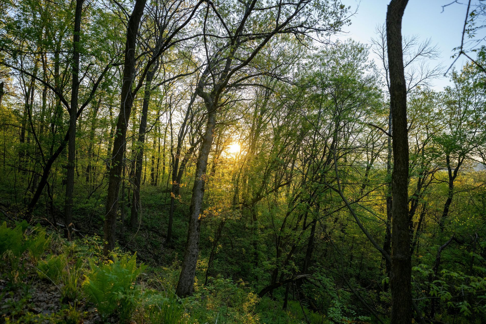
In the cycle of sustainable forestry, post-harvest assessment stands as a critical phase that determines the long-term health and productivity of timberlands. After logging operations, forests enter a vulnerable recovery period where regrowth must be monitored to ensure successful regeneration, while issues like soil erosion and habitat disruption are addressed promptly. Neglecting this stage can lead to diminished biodiversity, regulatory non-compliance, and reduced future yields. At Grade Timber, we leverage drone technology to provide efficient, non-invasive monitoring of regrowth and erosion, empowering landowners with actionable data
to facilitate swift interventions and promote ecosystem resilience. By utilizing unmanned aerial vehicles (UAVs), we transform post-harvest evaluation from a labor-intensive task into a precise, data-driven process that supports sustainable timber management.
The need for robust post-harvest monitoring is amplified by the environmental impacts of harvesting, such as soil compaction from machinery, which can exacerbate erosion and hinder natural regeneration. Traditional methods, including ground-based surveys and manual sampling, are often limited by terrain challenges and high costs, potentially overlooking subtle changes in vegetation cover or erosion patterns. Drones overcome these barriers by offering aerial perspectives that capture comprehensive, high-resolution data across large areas, enabling timely detection of recovery trends and potential problems.
The Grade Timber Methodology: Advanced Aerial Monitoring for Recovery Insights
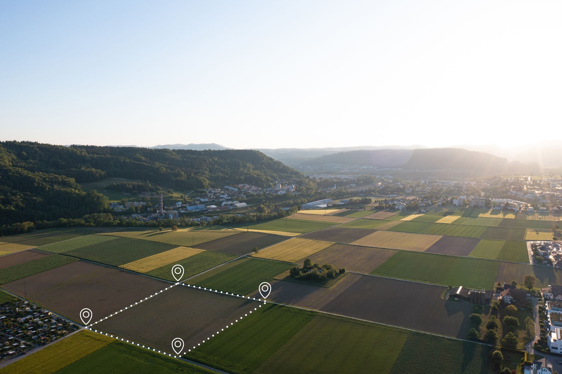
At Grade Timber, our drone services for post-harvest assessment employ UAVs equipped with multispectral cameras, LiDAR sensors, and thermal imaging to track vegetation dynamics and erosion features. Flights are conducted shortly after harvesting and at regular intervals—typically monthly during the initial recovery phase—to build time-series data on regrowth.academic.oup.com Multispectral imagery analyzes vegetation indices like NDVI to quantify regrowth rates, identifying areas of sparse recovery where supplemental planting may be needed.mdpi.com LiDAR generates detailed digital terrain models (DTMs) that reveal erosion gullies, wheel ruts from skidders, and soil displacement, with algorithms automating rut detection for precise mapping.academic.oup.com
The process involves pre-flight planning to optimize coverage, followed by data processing with AI tools that classify land changes and predict erosion risks.sciencedirect.com For example, deep learning models applied to drone imagery can map post-harvest wheel ruts with high accuracy, facilitating targeted soil stabilization efforts.academic.oup.com This cost-effective approach, as highlighted in forestry reviews, allows for rapid inventories that are faster and cheaper than crewed aircraft or ground teams.mdpi.com Integration with GIS platforms enables overlaying harvest data with recovery metrics, providing visualizations that guide interventions like erosion control measures or reseeding.
UAVs also support monitoring in challenging post-disturbance scenarios, such as after wildfires, where they assess burn severity and track vegetative ebound.crojfe.com Our methodology ensures minimal disturbance, aligning with best management practices (BMPs) for forestry, and delivers reports that include quantifiable metrics like canopy cover percentage and erosion volume estimates.degruyterbrill.com
Real-World Applications: Case Studies in Recovery Tracking
Drone technology's efficacy in post-harvest monitoring is demonstrated through numerous case studies across diverse ecosystems. In a study from western Norway, UAV data estimated post-harvest soil displacement and skid trail impacts on a 7-hectare site, revealing how harvesting machinery altered terrain and informing recovery strategies. Similarly, in the eastern Amazon, drone-based LiDAR assessed forest structure 30 years after timber harvesting, comparing reduced-impact logging (RIL) with conventional methods to evaluate long-term recovery of canopy height and biomass.researchgate.net This analysis showed that RIL sites exhibited faster structural regeneration, highlighting the value of pre-harvest planning informed by aerial data.
In burned areas, which often mimic post-harvest conditions in terms of soil exposure, drones have excelled in tracking recovery. A Ugandan case on Mount Elgon used UAV mapping to monitor land degradation from logging and fires over three years, identifying erosion hotspots and supporting community-led restoration.quora.com In the U.S. Pacific Northwest, drone LiDAR facilitated forest inventory post-harvest, estimating timber volume and tree heights to guide regeneration efforts in clearcut zones.bluefalconaerial.com Another example from Croatia involved RGB drone cameras recording forest road cross-sections and ditch depths post-harvest, detecting erosion features to prevent further degradation.sciencedirect.com
At Grade Timber, we've applied these techniques in North American timber operations, where drones monitored regrowth in jack pine stands after varying skidding treatments, assessing biomass retention and natural regeneration success.silvlib.cfans.umn.edu These applications underscore drones' role in providing timely data for adaptive management, such as adjusting harvest intensities to enhance recovery.
Compelling Benefits: Compliance, Cost Reductions, and Sustainability
The benefits of drone-assisted post-harvest monitoring are multifaceted, delivering economic, regulatory, and ecological advantages. Cost reductions are a primary draw: UAV surveys can achieve 40% savings compared to traditional methods by minimizing fieldwork and enabling frequent assessments without proportional expense increases.prism.sustainability-directory.com In forestry health monitoring, drones offer significant cost advantages over manned aircraft, with faster deployment and lower operational overheads.mdpi.com For instance, in spruce budworm monitoring, integrated drone approaches balanced costs with enhanced data accuracy.forestsmonitor.com
Compliance with environmental regulations is streamlined, as detailed drone reports demonstrate adherence to BMPs, such as erosion control under U.S. forestry
guidelines.sciencedirect.com This data supports certification for sustainable practices, potentially qualifying landowners for incentives like carbon credits through verified regeneration.news.mongabay.com Ecologically, early detection of issues like erosion prevents long-term damage, promoting biodiversity and soil ealth.blog.harbingerland.com Safety improves by reducing the need for ground crews in unstable post-harvest sites, while efficiency gains allow for proactive interventions that boost regrowth rates.cid-inc.com
Broader industry benefits include optimized future harvests, as recovery data informs rotation cycles and species selection.interpine.nz Studies show that drone monitoring enhances tree stocking levels, directly impacting yield projections and profitability.agremo.com
Looking Ahead: Innovations in Post-Harvest Technology
The future of post-harvest assessment lies in deeper integrations of AI and remote sensing. Predictive models could forecast regrowth trajectories based on drone time-series, incorporating climate data for resilient planning.sciencedirect.com Autonomous drone swarms might enable continuous monitoring, while hyperspectral sensors advance erosion detection.researchgate.net At Grade Timber, we're exploring these to further refine recovery strategies, including hybrid systems with satellite imagery for large-scale operations.news.mongabay.com
Ensure Your Forest's Recovery with Grade Timber
In summary, post-harvest assessment through drone technology is essential for ensuring forest recovery, mitigating erosion, and sustaining timber operations. Grade Timber's services provide the tools for precise monitoring, driving compliance, cost savings, and environmental stewardship. Contact us today for a consultation and secure a thriving future for your timberlands.