Road and Infrastructure Layout in Timber Operations
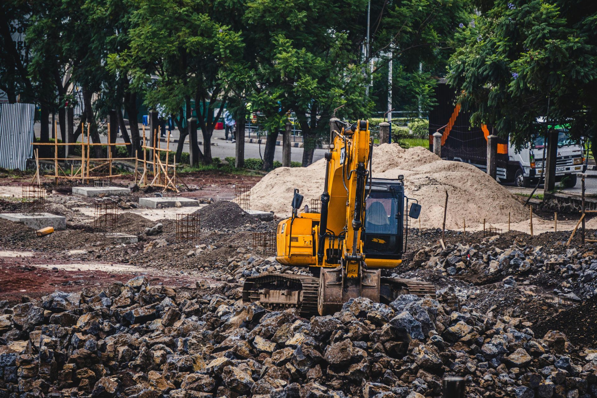
In the demanding world of timber operations, the design and layout of roads and infrastructure play a pivotal role in ensuring efficiency, safety, and environmental sustainability. Poorly planned logging roads can lead to excessive soil erosion, habitat disruption, and increased operational costs, exacerbating the challenges of accessing remote forested areas. Traditional methods, such as manual surveys and ground-based mapping, are often cumbersome, time-intensive, and prone to inaccuracies in rugged terrains. At Grade Timber, we harness drone technology to streamline this process, providing aerial mapping that optimizes road layouts while minimizing ecological impacts like erosion. By integrating unmanned aerial vehicles (UAVs) into infrastructure planning, we enable timber operators to create networks that avoid sensitive zones, reduce environmental footprints, and enhance overall productivity.
The imperative for efficient infrastructure in timber harvesting cannot be overstated. Logging roads must balance accessibility for heavy machinery with the need to preserve soil stability and water quality. Erosion from poorly constructed paths can lead to sedimentation in waterways, affecting aquatic ecosystems and regulatory compliance. Drones offer a transformative solution by delivering high-resolution data that informs precise layouts, ensuring roads follow natural contours and steer clear of wetlands or steep slopes.sciencedirect.com This approach not only mitigates erosion but also aligns with best management practices (BMPs) for sustainable
forestry.
The Grade Timber Methodology: Aerial Precision for Infrastructure Design
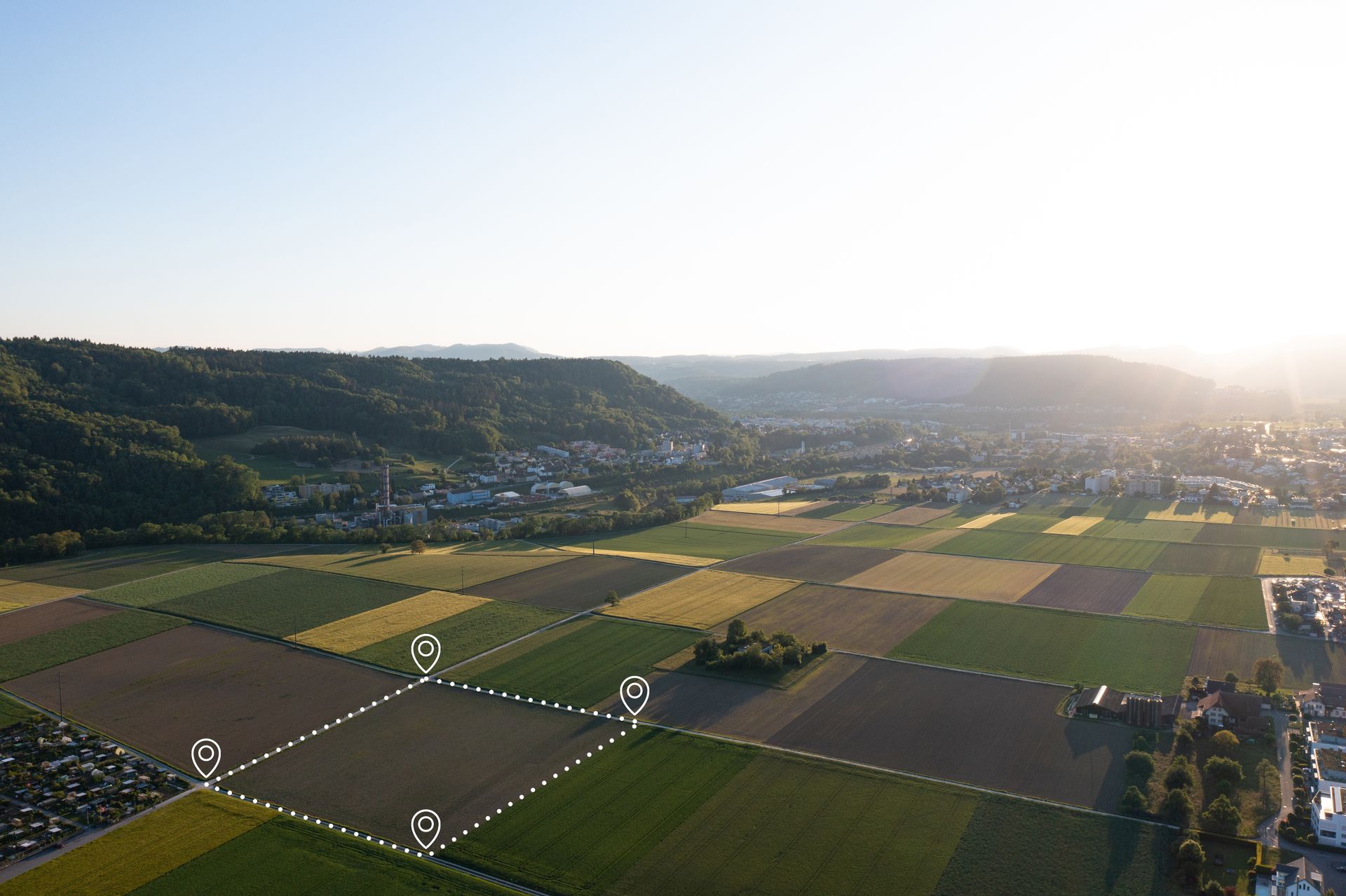
At Grade Timber, our drone services employ advanced UAVs equipped with LiDAR, photogrammetry, and multispectral sensors to conduct comprehensive site assessments for road and infrastructure layout. The process starts with flight planning: Drones are programmed to cover the operational area in systematic grids, capturing data at low altitudes for detailed resolution.fs.usda.gov LiDAR penetrates canopy cover to generate accurate digital elevation models (DEMs) and terrain profiles, identifying optimal routes that minimize cut-and-fill volumes and erosion risks.learn.rockrobotic.com Photogrammetry stitches high-resolution images into orthomosaics, revealing vegetation patterns and soil types to avoid ecologically sensitive areas.
A key innovation is the use of AI algorithms to analyze drone data, automating the detection of potential erosion hotspots like wheel ruts from previous operations.academic.oup.com For instance, deep learning models process imagery to map ruts with high accuracy, allowing planners to design roads that circumvent unstable ground.academic.oup.com Multispectral sensors assess soil moisture and vegetation health, ensuring infrastructure avoids waterlogged zones prone to runoff. This data integrates with GIS software for 3D simulations, enabling virtual testing of road designs before ground-breaking.
Compared to traditional surveys, which might require weeks of fieldwork, drone missions complete in hours, providing real-time insights that enhance safety by reducing exposure to hazardous terrains.rayonier.com In cable logging operations, drones scout steep slopes for tower placements, improving efficiency and reducing fatigue for crews.forestnet.com Our methodology also includes post-construction monitoring, where follow-up flights track erosion and maintenance needs, ensuring long-term infrastructure integrity.
Real-World Applications: Case Studies in Erosion Reduction and Efficiency
Drone-assisted infrastructure planning has proven its mettle in various timber operations worldwide. In the southeastern United States' coastal plain, a study evaluated UAVs for monitoring forestry BMPs, including road construction.sciencedirect.com Drones captured detailed imagery of road networks, identifying erosion-prone sections and enabling adjustments that reduced sediment runoff into streams. This feasibility assessment highlighted drones' potential for cost-effective compliance with environmental regulations.
Another compelling case comes from Mount Elgon, Uganda, where drone mapping combined with community insights assessed land degradation from logging activities.mdpi.com Over six sites monitored from 2020 to 2023, UAVs revealed erosion hotspots along access roads, informing restoration efforts that stabilized soils and restored vegetation.researchgate.net Household surveys complemented the data, showing how drone-informed road redesigns minimized community impacts.
In European contexts, Croatian research analyzed UAVs with RGB cameras for recording forest road cross-sections and ditch depths.mdpi.com This approach detected erosion features with precision, aiding in maintenance that prevented further degradation. Similarly, in post-disaster scenarios, stakeholder perceptions in New Zealand emphasized drones' role in reducing landslide risks through erosion monitoring and road planning.besjournals.onlinelibrary.wiley.com
Closer to home, U.S. timber companies like Rayonier have adopted high-power drones for tower logging on steep mountainsides, where traditional methods posed safety risks.rayonier.com Drones facilitated rapid infrastructure layout, completing tasks in minutes that once took days, while avoiding erosion-vulnerable areas. These case studies underscore drones' versatility in diverse terrains, from tropical forests to mountainous regions, consistently reducing environmental footprints in construction and harvesting.
Compelling Benefits: Cost Savings, Sustainability, and Safety
The adoption of drones in timber infrastructure layout yields substantial benefits across economic, environmental, and operational dimensions. Cost savings are particularly notable: Surveys indicate reductions of 30-50% in planning and construction expenses, as drones slash labor hours and equipment needs compared to manual methods.na.develon-ce.com In forestry applications, UAVs provide data at a fraction of the cost of traditional aerial surveys, with one systematic review highlighting their cost-effectiveness in inventory and mapping.researchgate.net For instance, consumer drones enable aerial inventories of spruce seedlings with deep learning, offering accurate, low-cost solutions for post-harvest road assessments.mdpi.com
Sustainability gains are equally impressive. By optimizing road layouts to avoid sensitive areas, drones minimize erosion and habitat disruption, supporting biodiversity and water quality.rvslandsurveyors.com Enhanced planning reduces the overall road density needed, lowering the environmental footprint of timber operations.esri.com Safety improvements are critical too—drones eliminate the need for workers in dangerous zones, as seen in cable logging where UAVs handle scouting tasks.forestnet.com Broader benefits include faster project timelines, improved regulatory compliance, and data-driven decisions that boost long-term forest health.dronedeploy.com
Looking Ahead: Innovations in Drone Technology for Timber Infrastructure
The future of road and infrastructure layout in timber operations is bright, with advancements like AI-enhanced predictive modeling and autonomous drone swarms on the horizon.sciencedirect.com Integrations with real-time GIS will allow dynamic adjustments during operations, further reducing erosion risks. At Grade Timber, we're exploring these technologies to push the boundaries of precision forestry.
Optimize Your Timber Operations with Grade Timber
In conclusion, drone technology is redefining road and infrastructure layout in timber operations, delivering efficiency, cost savings, and sustainability. By minimizing erosion and environmental impacts, Grade Timber empowers operators to achieve balanced, profitable outcomes. Contact us today for a consultation and transform your infrastructure planning