Forestry Drone Mapping Services by Grade Timber
Empowering Illinois Landowners with Precise Mapping and Planning Tools
Manage Your Land Effectively
As a landowner in central or southern Illinois, you want to make the most of your property. This could mean harvesting timber for profit, protecting wildlife, or ensuring long-term sustainability. Our drone services provide accurate data to help you make informed decisions.
Why Choose Grade Timber?
We specialize in logging, land clearing, and timber buying across Illinois, including Jefferson County, IL. With years of experience on thousands of acres, we understand your needs. Our advanced drone services deliver fast, safe, and reliable insights for better land management. All equipment is NDAA-compliant and built for heavy-duty tasks.
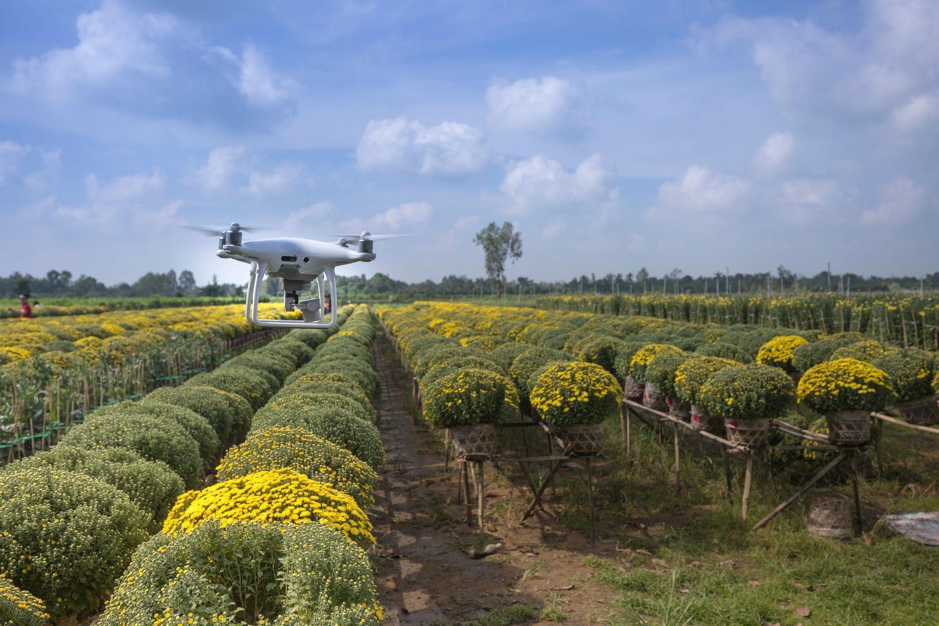
Key Capabilities of Our Drone Services
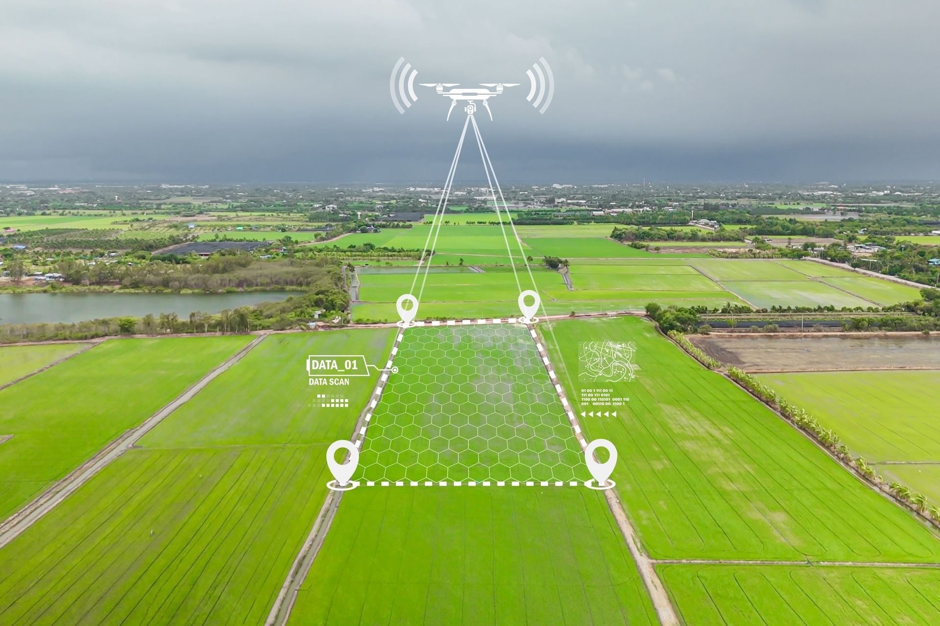
Using high-performance drones, we offer:
Extended Flight Times: Up to 43 minutes per flight, covering large areas (up to 100 acres) efficiently, even with heavy sensors.
Heavy Payload Support: Handles up to 19 lbs of sensors, allowing integration of multiple tools for comprehensive data collection.
High-Resolution Imaging: 100-megapixel cameras capture detailed images at resolutions of 11,664 x 8,750 pixels, with dynamic range up to 83 dB for clear, sharp forest maps in RGB or achromatic modes.
Fast Capture Rates: Up to 2 frames per second with shutter speeds as quick as 1/2500 second, enabling rapid surveying of dynamic environments.
LiDAR Integration: Provides precise 3D mapping for tree height, volume estimation, terrain modeling, and canopy analysis, supporting payloads under 9 kg for accurate forestry data.
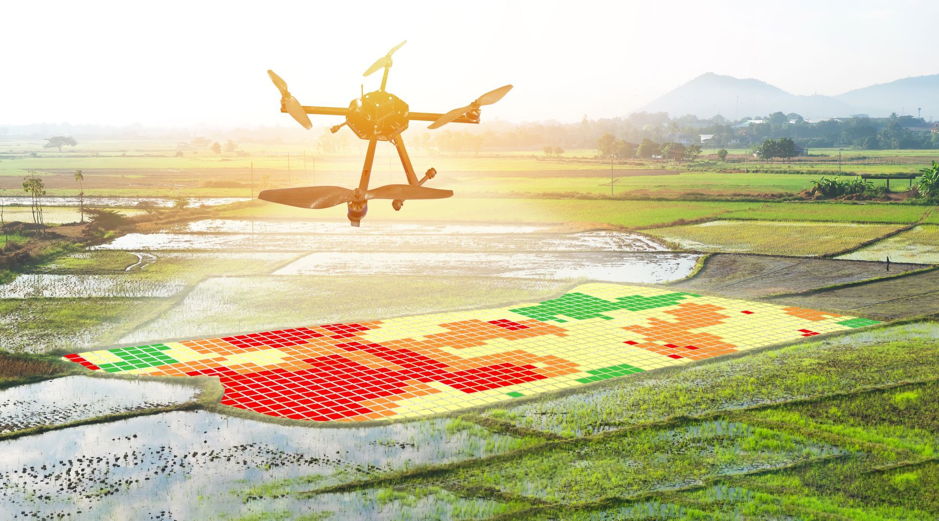
Multispectral and Thermal Sensing: Detects vegetation health, pests, diseases, and heat variations to identify issues early.
Safety and Reliability: Continues safe operation even with motor failure, with real-time first-person view for precise control in challenging terrains.
High Speed and Endurance: Reaches speeds up to 56 mph, ideal for covering vast woodlands quickly.
Data Connectivity: USB-C and 10G Ethernet for fast transfer of large datasets, ensuring quick analysis.
These features enable detailed aerial surveys, 3D modeling, and health monitoring without ground disruption.
How Our Process Works
1. Free Consultation
Discuss your property needs and goals.
2. On-Site Data Collection
Remove stumps to prepare land for building or planting.
3. Detailed Report
Get actionable insights, including maps, health assessments, and planning recommendations.
Risks of Not Using Advanced Tools
Sticking to manual methods may lead to overharvesting valuable trees like walnut or white oak, undetected diseases spreading, or regulatory fines for habitat issues. This can increase costs and damage your land permanently.
Benefits of Our Drone Services
Optimize harvests for maximum profit.
Monitor and restore areas with verifiable data.
Achieve eco-friendly practices, potentially qualifying for carbon credits.
Build healthier forests and a valuable legacy.
Our Services and Pricing
We've improved our pricing to offer clear, tiered options based on the complexity and sensors used. This ensures transparency and value, with per-acre rates that scale for larger properties. Pricing starts at competitive rates aligned with industry standards for high-quality drone mapping.Minimum project size is 50 acres; contact us for custom quotes on larger areas or additional services like harvest planning.
| Service | Tier | Description & Benefits | Pricing (Per Acre) | Minimum Charge |
|---|---|---|---|---|
| Forest Inventory and Mapping | Basic (Photogrammetry) | Accurate tree counts, species identification, and 2D maps to avoid waste | $10–$15/ $500 (up to 50 acres) | $500 (up to 50 acres) |
| Forest Inventory and Mapping | Advanced (Multispectral + LiDAR) | Includes volume measurements, 3D terrain models, and basic health insights | $20–$30 | $750 (up to 50 acres) |
| Vegetation Health Monitoring | Basic (Multispectral) | Early detection of pests, diseases, and stress for proactive management | $12–$18 | $500 (up to 50 acres) |
| Vegetation Health Monitoring | Premium (Thermal + LiDAR) | Comprehensive analysis with heat variations, 3D canopy mapping, and detailed reports | $25–$35 | $1,000 (up to 50 acres) |
Combined packages for both services save 15–20% on total costs.
Take the Next Step
Contact us for a free consultation and quote. Call (309) 472-7867 or email info@gradetimber.com. Start managing your land smarter today.
Contact Us
Thank you! We’ll contact you soon to schedule your free land clearing consultation.
Please try again later.
- Contact Grade Timber: (309) 472-7867 | info@gradetimber.com
- www.gradetimber.com
- © 2025 Grade Timber. All rights reserved.